
On a clear day, I can see Mont Blanc on the skyline from my office window, and many is the day in winter where I watch the sun rise almost directly over the summit. Mont Blanc looms over the skyline in many places around Geneva and the “frontalier” France to the west. So I had long had an ambition to climb Mont Blanc, the highest peak in (Western) Europe at 4808m, and succeeded on my first attempt in September 2010.
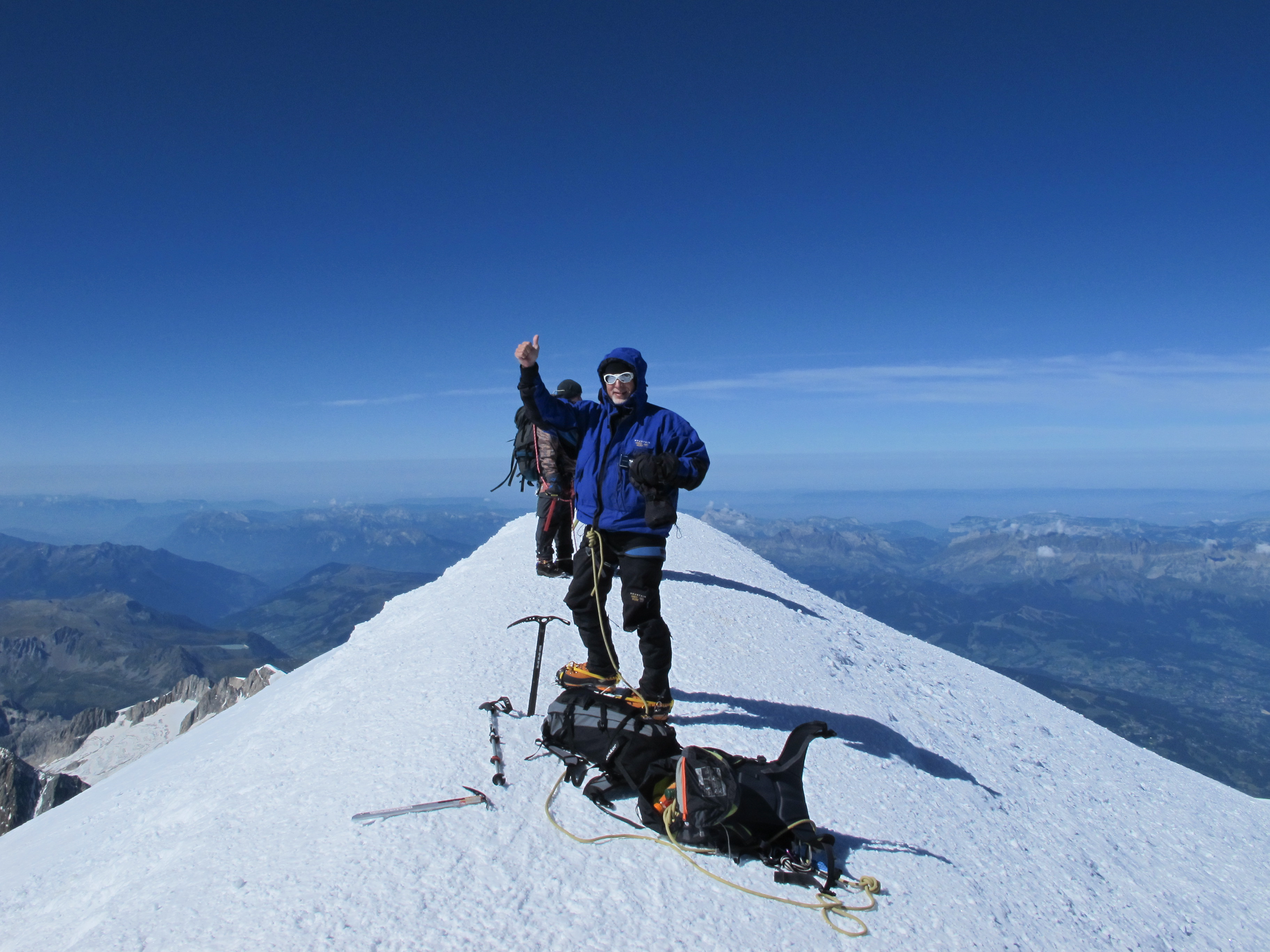
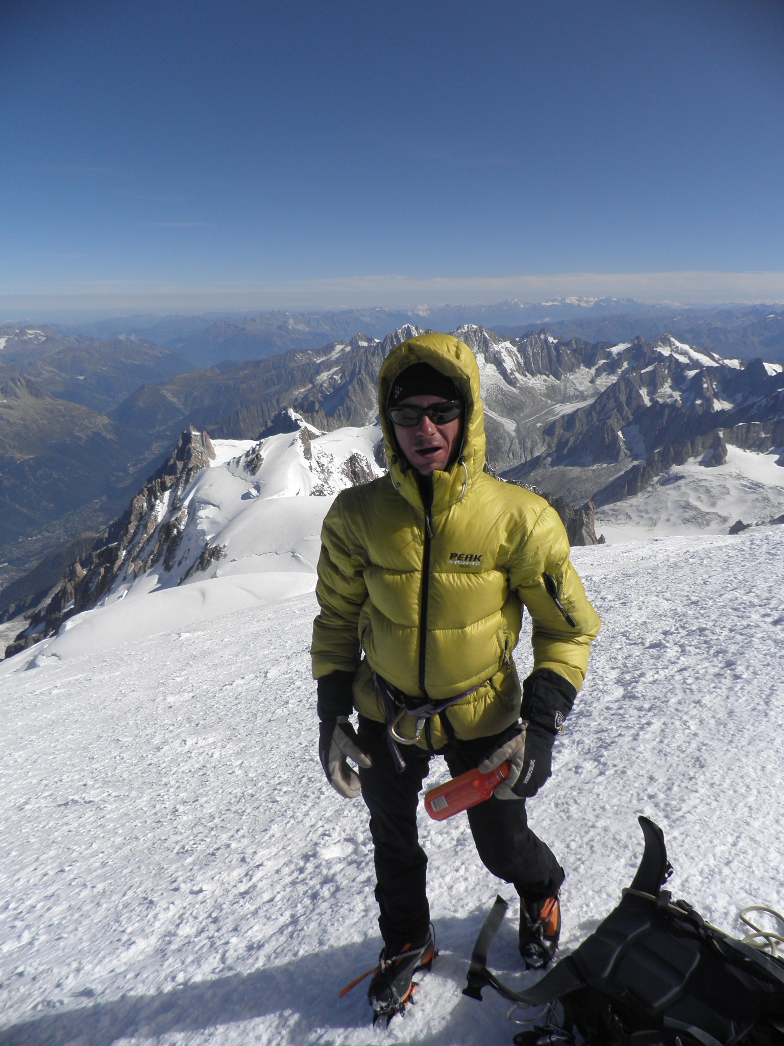
On the summit of Mont Blanc (4808 m), Sunday morning at 11.30 am. And somewhat surprised I made it!
Although the easier routes on Mont Blanc are not technically difficult, they do require a good level of fitness, an ability to move on very exposed rock and snow, and familiarity with use of crampons and ice axe. But Mont Blanc is not a light undertaking, there is a considerable degree of objective risk from avalanches and rock falls. In fact, in terms of total deaths, the Mont Blanc massif is considered the most dangerous mountain in the world, with dozens (some estimate up to 100) deaths per year (the-list-the-deadliest-mountains-in-the-universe). Although some of these reflect the sheer numbers of inexperienced people attempting the climb, and the pressures to continue when conditions are not ideal, the dangers are real – avalanches, rock falls, severe weather. For example, in July 2008, four climbers perished in a severe storm, only hundreds of metres from a shelter, and in July 2012, nine climbers were killed by an avalanche on the standard “Three Mont Blancs” route.
I had previous experience in climbing a 4000m peak in the Alps (my-first-4000m-peak-in-the-swiss-alps) and also planned a preparatory climb in July 2010 in preparation for the Mont Blanc attempt. A friend and I went with a mountain guide, Yannick Flugi to climb Gran Paradiso, the highest mountain completely in Italy (4060 m). We got to within about 300 m of the summit, but turned back when my friend developed some breathing problems from the altitude.
We decided not to attempt Mont Blanc that year, and I arranged to do another climbing trip with Yannick in September. However, he rang the day before we were due to leave to say the weather was perfect for Mont Blanc, and he thought I was ready for it. My training consisted of regular indoor cycling for an hour twice a week, running several days a week, and on the weekend, one or two runs up and down the Saleve, an ascent and descent of around 700 metres, that I would do in just over one hour. But I was not adapted to high altitude and knew that the three day trip would not give me time to acclimatize and adapt. So I would be relying on my fitness to keep me going at altitude.
Yannick decided that we would attempt the Gouter Ridge route, to avoid a potential avalanche risk that he had seen on a previous trip via the Three Mont Blancs route, due to dangerously overhanging seracs. The Gouter Ridge route is the most direct route, but involves an ascent of the Gouter Ridge where there is quite a danger from rock falls. Yannick planned to minimize this risk by staying at the Tete Rousse hut at the base of the Ridge, and climbing it in the dark before dawn, stopping for a break at the Gouter Hut at the top of the ridge, before heading to the summit. The route is visible in the photo below, that I took in December 2010 from near Divonne. The line between the sun and shadow is pretty much the route that we took.
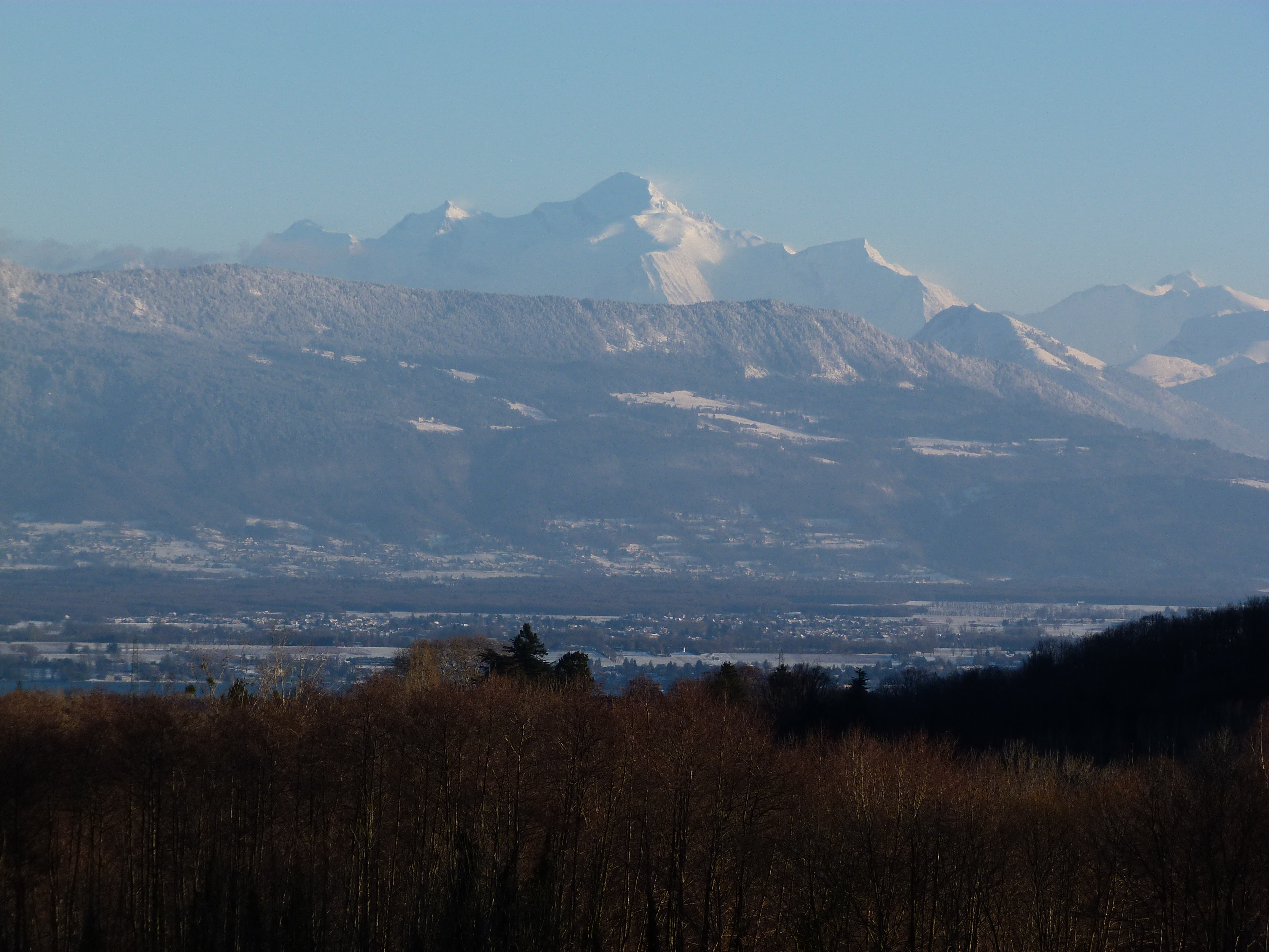
Mont Blanc seen from Divonne, France
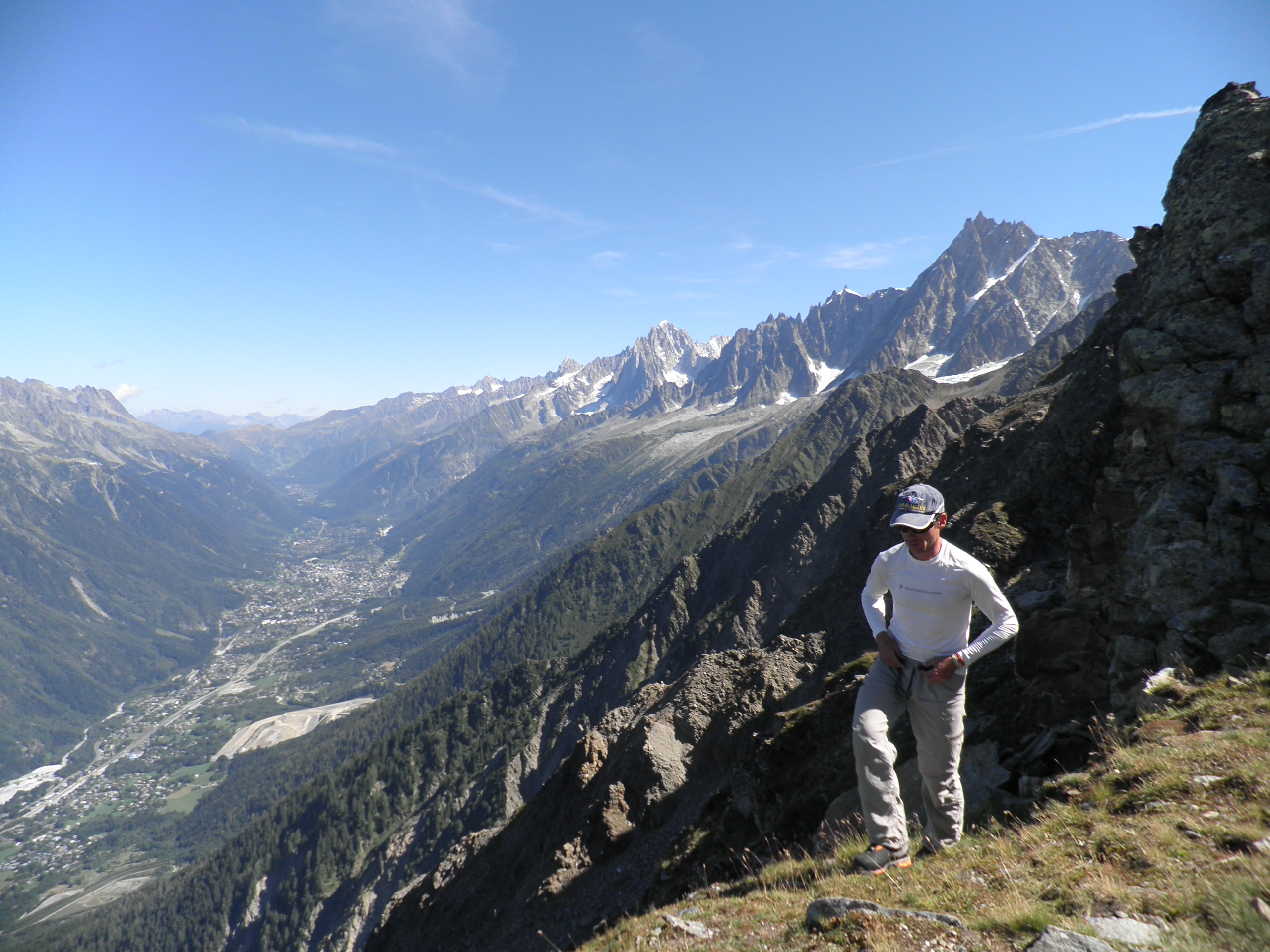
We set off on Saturday morning, catching Tramway du Mont Blanc from Les Houches partway up the foothills, and then walking up about 800m to the Refuge. Below is Yannick on the ridge leading up to Tete Rousse refuge, with Chamonix in the valley below.
We stayed at the Tete Rousse refuge on Saturday night and returned to it Sunday night after reaching the summit (4808 m). It is perched on a ridge between the Bionnassay Glacier and the Tete Rousse Glacier.
Tete Rousse refuge at 3167 m.
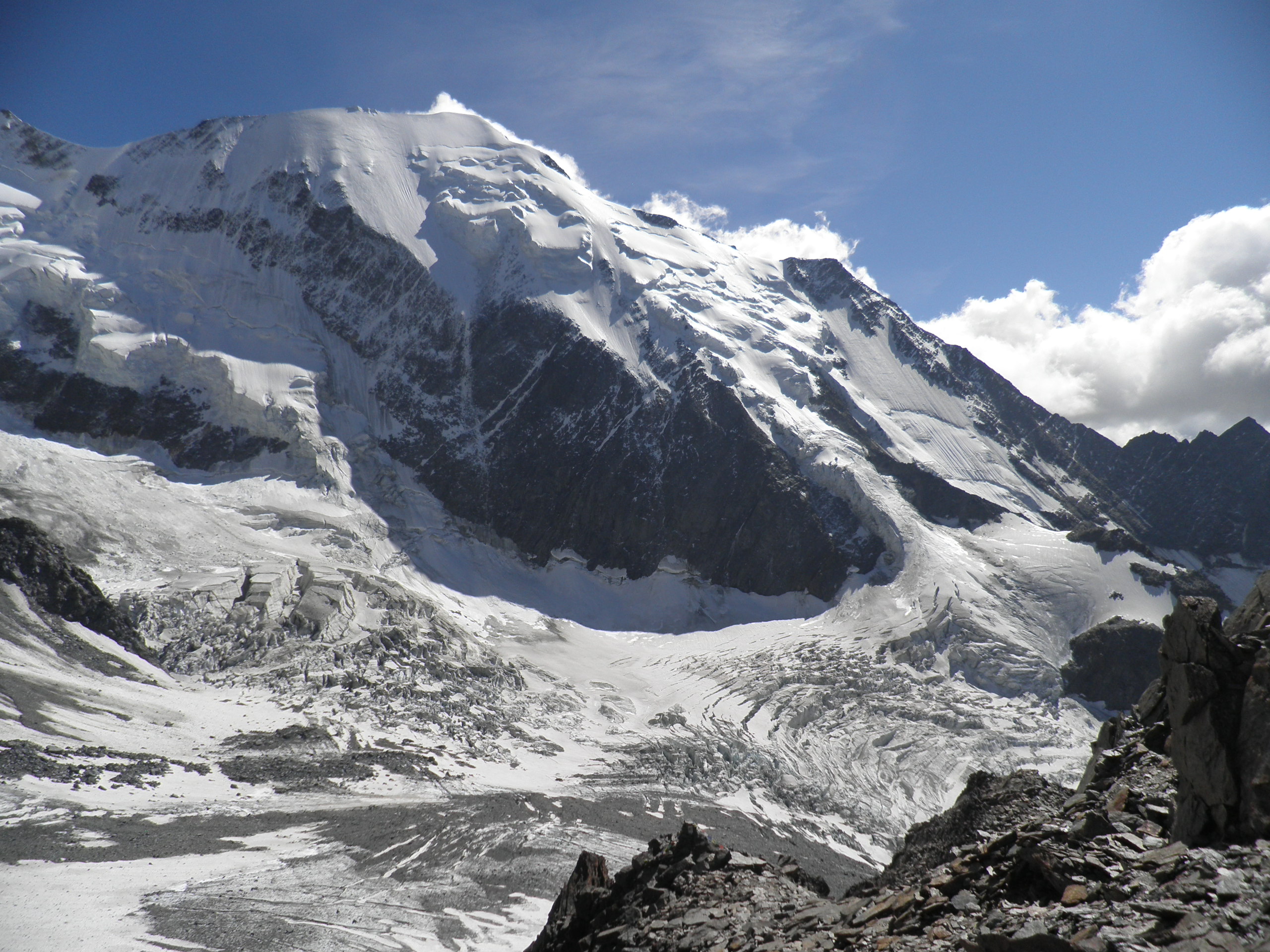
View of the Bionnassay Glacier from the Tete Rousse refuge.
Below is the view of the Aiguille de Gouter from Tete Rousse. The Gouter refuge is visible at the very top 700m above Tete Rousse. The route up is steep, exposed and subject to frequent rock falls. I was quite daunted at the thought of climbing it in the dark the next morning.
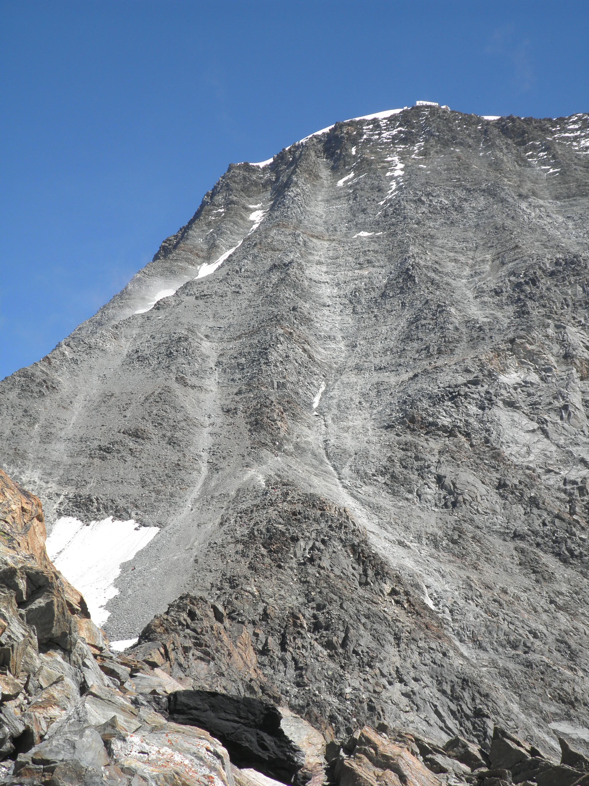
Aiguille de Gouter
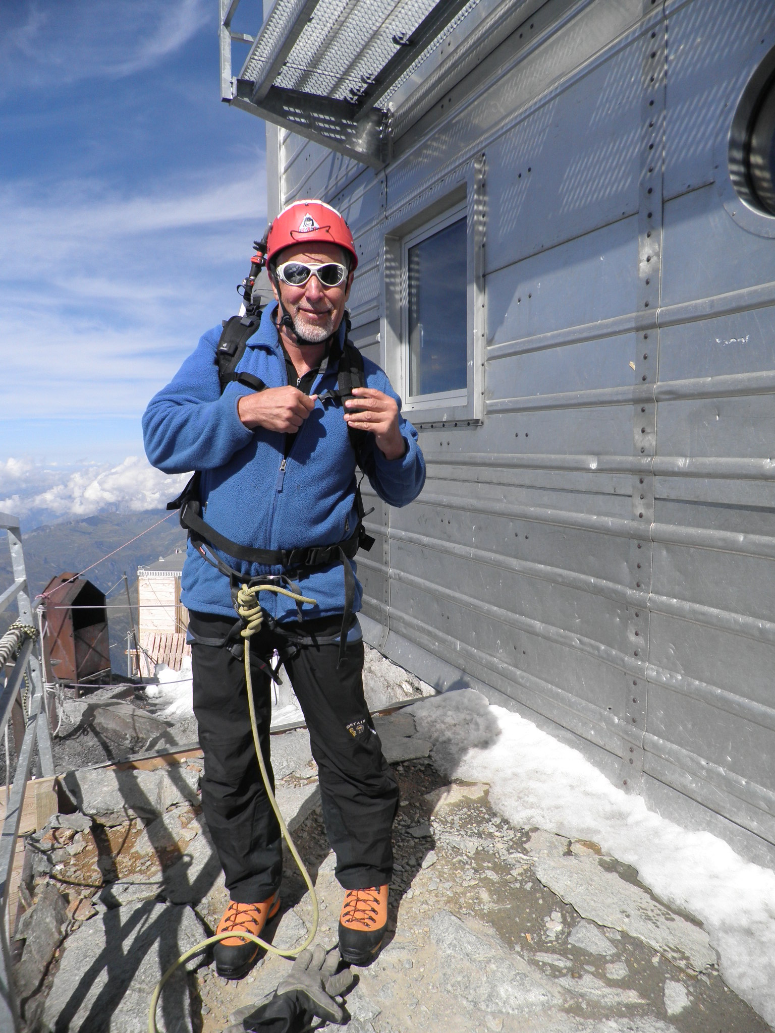
We got up at 4 am for a quick breakfast and then the ascent of the Aiguille de Gouter in the dark.This is me looking daunted.
At the base of the Aiguille de Gouter at 4 am
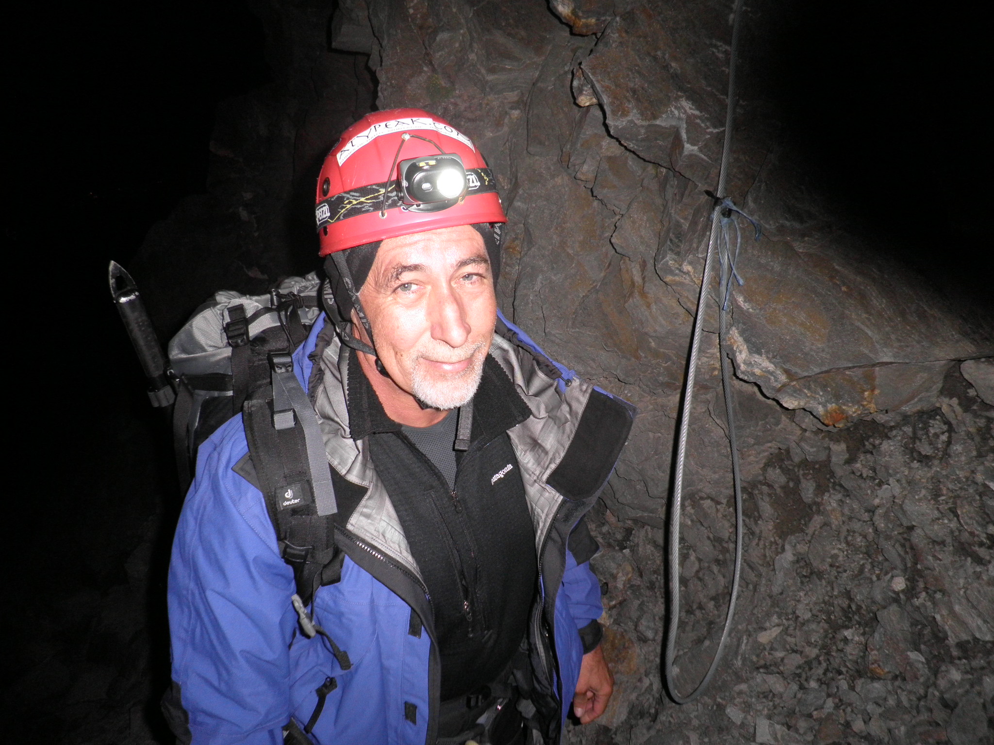
In fact, the climbing by headlight was quite straightforward, particularly as the headlamps did not really illuminate the exposure. After two hour climb in the dark, we reached the Gouter Refuge (3817 m) and had an hours rest. The top part of the climb was steep, almost rock climbing, and some cables were strung for assistance and for belaying. The top of the last cable is visible in this photo and is on the start of the route down.
Gouter Refuge (3817m) at the top of the Aiguille de Gouter
Above the Gouter hut, we left the rock and the rest of the ascent was on snow and ice to the summit. The first part of the route ascends the Dôme du Gouter, whose top is 500 m above the Gouter hut. The photo below of me climbing the Dôme was taken by Yannick. As were the next couple of photos, I was too busy keeping my feet moving to take the camera out before the summit.
Ascending the Dome du Gouter
The following photo is looking up the summit ridge from the Dome du Gouter. The Vallon emergency shelter (4262 m) is visible in the middle of the photo. Above it is the steep slope leading to the Bosses Ridge and the “dromedary humps”. The cloud over the summit disappeared before we got there.
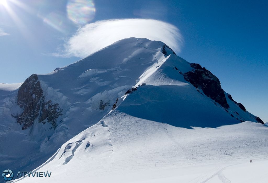
Looking up the summit ridge from the Dome du Gouter.
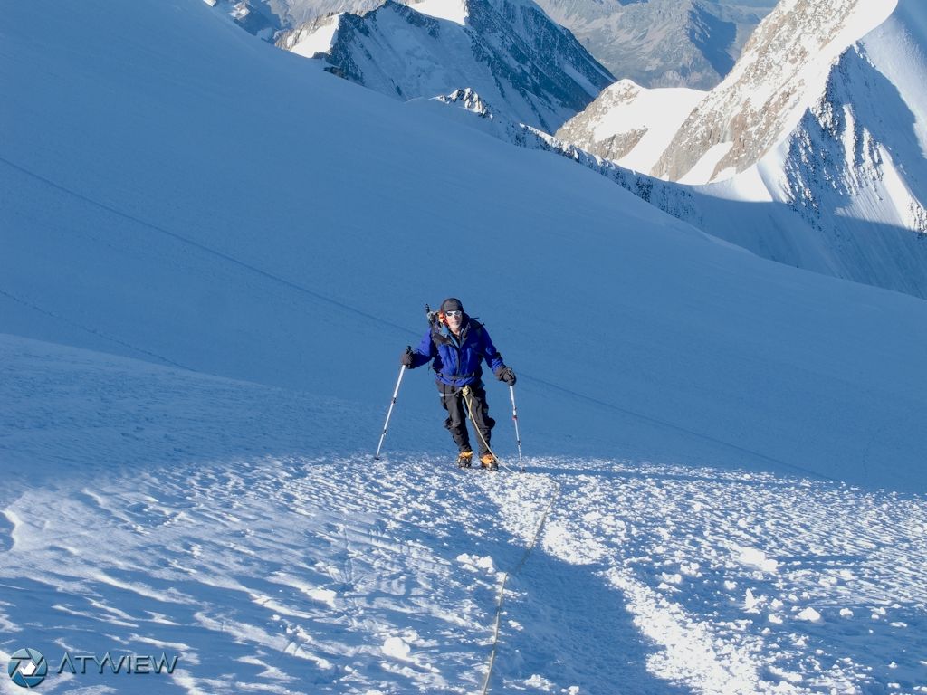
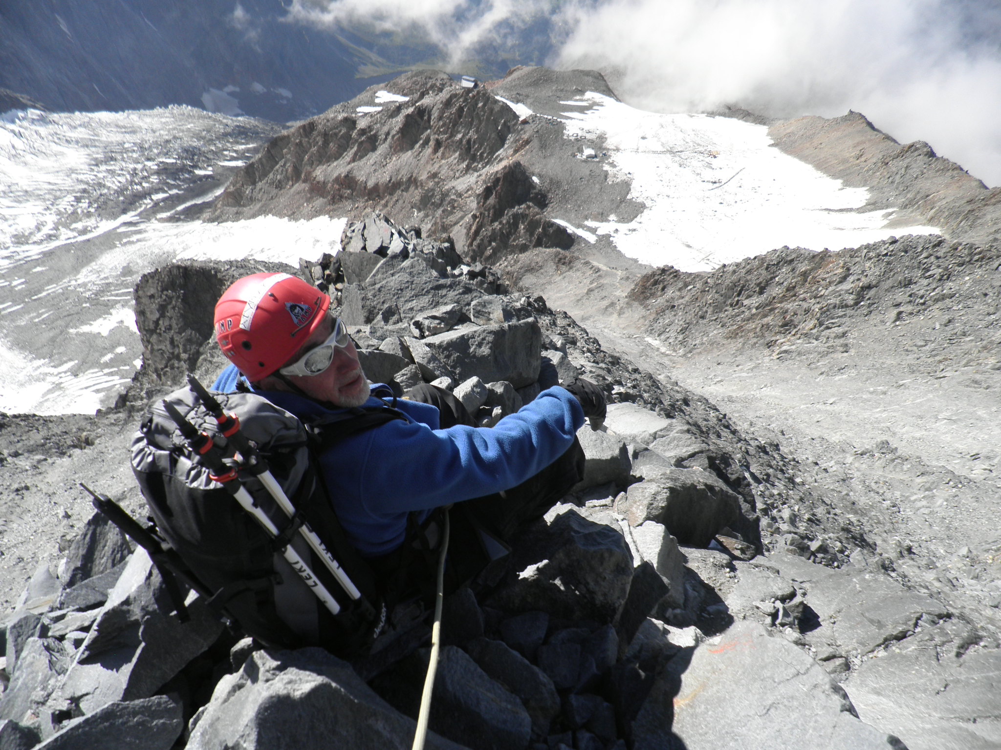
Above the Dome du Gouter is another 500 metres height to the summit. Yannick described it as going over five “bumps” to get to the top. While I did not get altitude sickness, I was feeling totally exhausted, no doubt the lack of oxygen in the air was a factor. There were several times when I stopped, convinced I could not lift my body another step. Yannick somehow persuaded me I could keep going. At one point, I said I really could not keep going. Yannick just turned started going back, and said OK we go down. It was enough to motivate me to keep going. This photo is on one of the “bumps”.
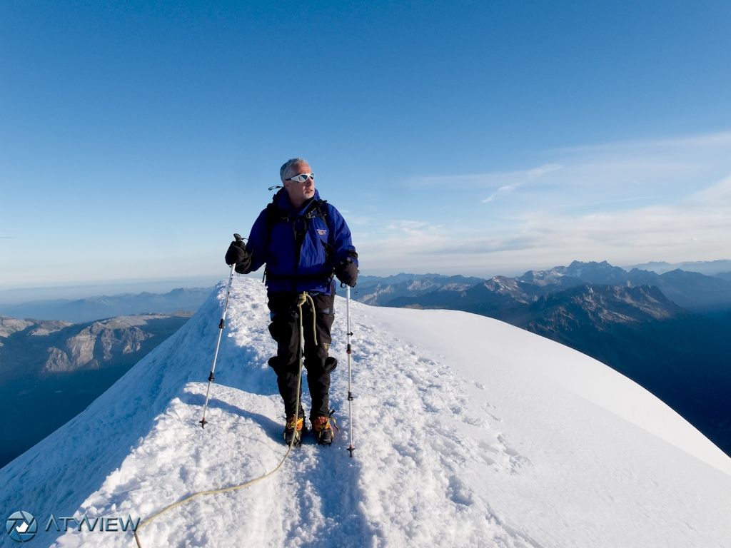
It took us four hours from the Gouter hut, and we reached the top at 11.30 am on Sunday, 5 September 2010. I had expected it to be hard, but it was still harder than I expected! And it was perfect weather, with unbelievable views. I was exhausted. But conditions were great with no wind, and after 10 minutes or so rest plus a drink and snack, I was feeling much better.
On the summit of Mont Blanc (4808 m).
And then I could really enjoy the view. I really felt on top of the world (at least the European world).
Yannick on the summit
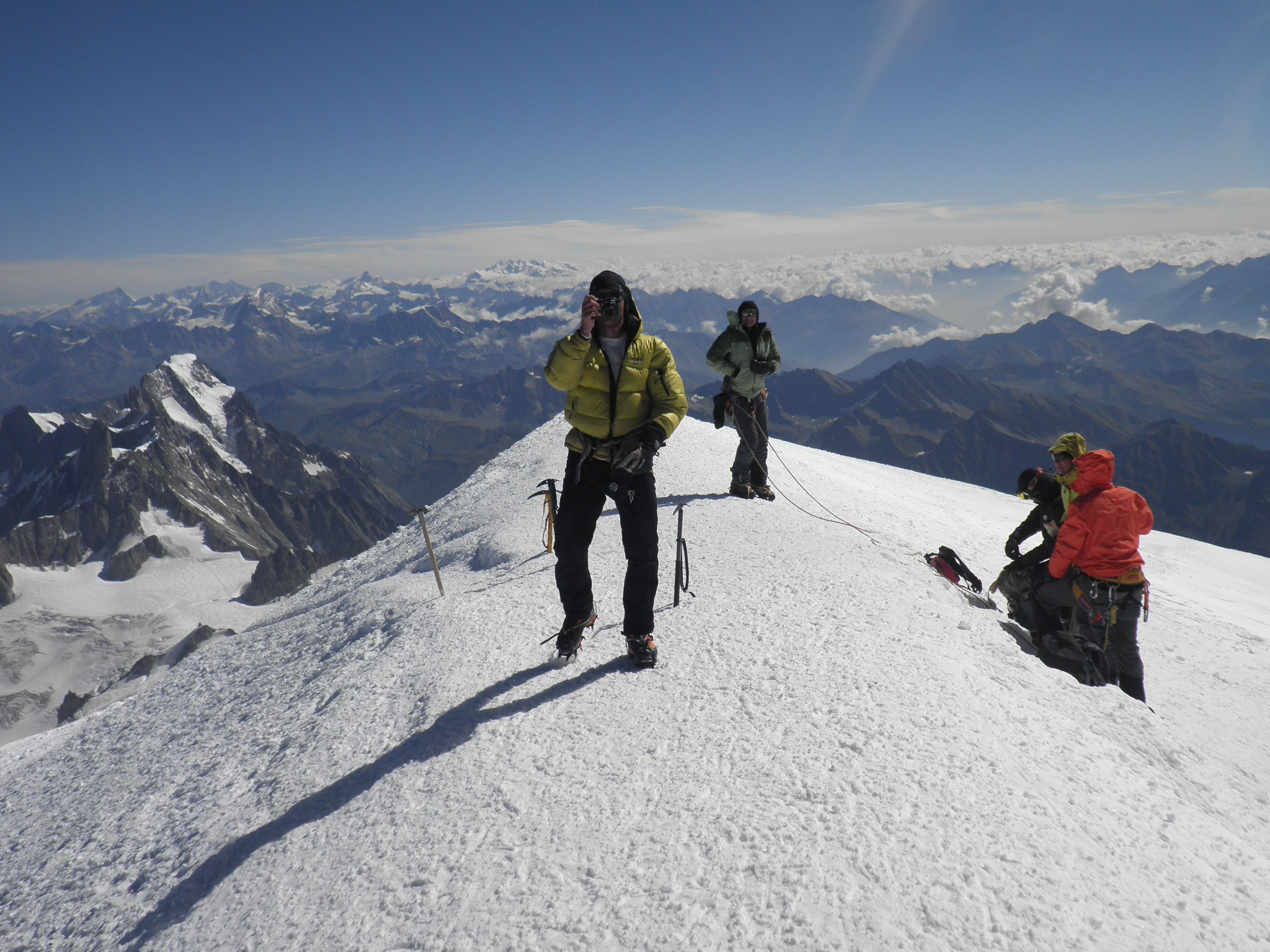
OLYMPUS DIGITAL CAMERA
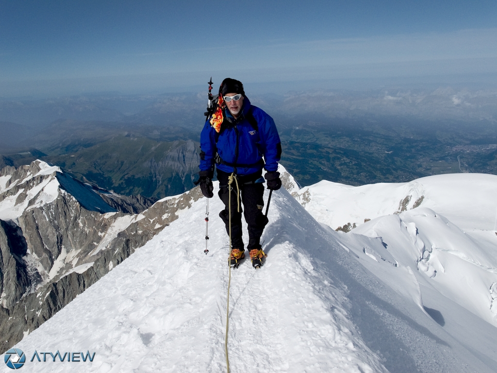
In the second photo above, Yannick is taking a photo of me. Behind his head on the left is the Monte Rosa massif on the horizon (the highest mountain in Switzerland) and a little further to the left can be seen the tip of the Matterhorn. After about 15 or 20 minuntes on the summit, we headed back down and had a brief rest when we got down to the Vallot shelter. We met a lone climber from Eastern Europe, who spoke not a word of any language we spoke, and Yannick unsuccessfully tried to tell him the weather was turning and he should not continue up on his own. The clouds came over the summit soon after we left. The photo below is looking back to the summit, it was again covered by a cloud and conditions were changing. The weather forecast was for bad weather the next few days (as subsequently happened) and we were lucky to have perfect weather on the weekend for the ascent.
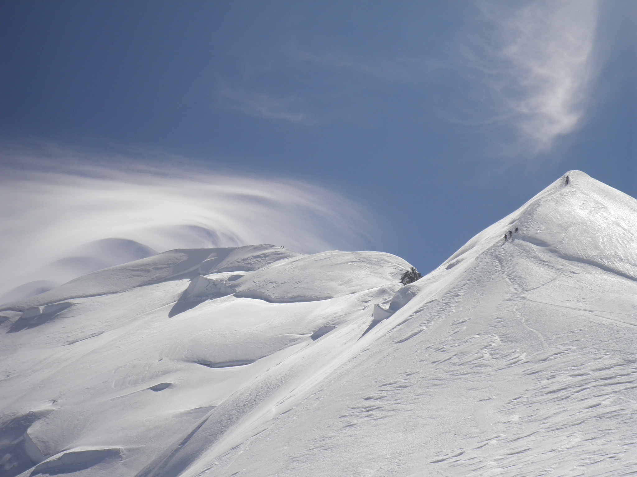
Looking back towards the summit
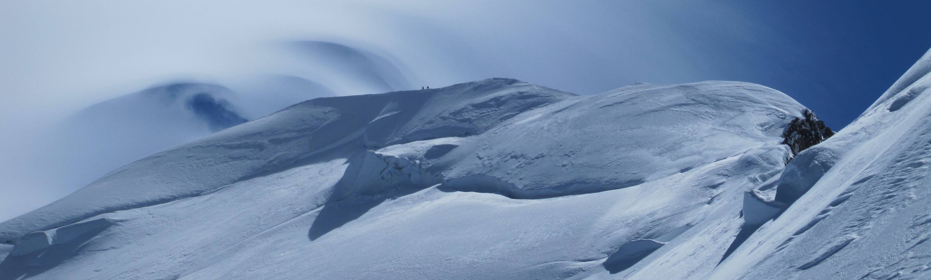
Deteriorating weather on the summit ridge of Mont Blanc
Back to the Gouter hut, we had another rest for an hour and half before tackling the climb down the Gouter ridge. After a bowl of pasta and a coke I felt ready to rope up for the climb down.
At the Gouter Hut
I led the way, with Yannick belaying from above. The photo below is looking down the ridge to the Tete Rousse Glacier about 600 m below. We stuck to the rocky ridge below me to avoid the stone falls in the gully to the right that we had climbed in the morning. Just as well, there was a massive stone fall in the gully when we were half way down with many boulders up to half a metre diameter bouncing down the gully. The first I knew of the stone fall was when Yannick started to yell “Caillers” at the top of his lungs, to alert some climbers lower in the gully. My initial puzzlement was soon dispelled as some quite large boulders bounced past us, making a huge noise.
Looking down the ridge to the Tete Rousse Glacier about 600 m below.
We had to cross the gully to get to the top of the Tete Rousse Glacier. After seeing the rock fall, I was motivated to cross quickly. We had also seen a woman struck in the chest by a fist-size rock dislodged by a climber above.
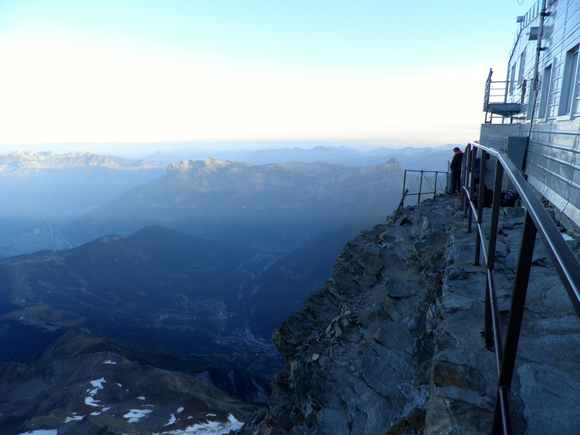
We stayed Sunday night at Tete Rousse refuge again. The next morning we slept in till 7 am and dropped another 1000 m down Les Rognes ridge to the middle station of a tramway which connected to a cable car, and back down to the valley (photo below). The ridge was quite exposed in one place and we roped up again for it.  Thanks to Yannick Flugi, mountain guide based in Geneva (atypeak.com) for excellent planning, guiding and encouragement. Someone who pays close attention to the weather and the risks, and is completely willing to abort if conditions are not reasonable.

Pingback: Skiing in the French Alps | Mountains and rivers
Pingback: Skiing in the French Alps | Mountains and rivers