At the beginning of December, 118 forest fires were burning in NSW, 48 of them out of control. The bushfire season started much earlier this year, with more than 140 fires in northern New South Wales (NSW) and Queensland, which destroyed over 600 homes and killed six people. One of these fires destroyed the Binna Burra resort in the Lamington National Park, as well as surrounding rainforest. This was followed by another outbreak of bushfires in November, with more than 129 bushfires in NSW and Queensland. At least 200 houses were destroyed and four people killed.
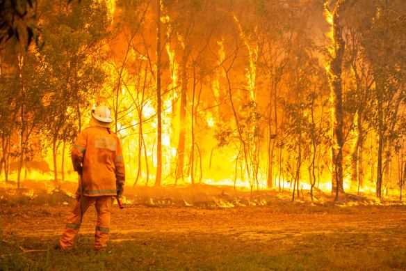
By the end of November, around 2 million hectares (5 million acres) of bushland had been burnt, and all this before the start of summer and the traditional bushfire season According to the Climate Council of Australia, the catastrophic, unprecedented fire conditions currently affecting NSW and Queensland have been aggravated by climate change. Bushfire risk was exacerbated by record breaking drought, very dry fuels and soils, and record breaking heat. Since the mid-1990s, southeast Australia has experienced a 15% decline in late autumn and early winter rainfall and a 25% decline in average rainfall in April and May. Across Australia average temperature has increased leading to more record breaking hot weather. Extreme fire danger days have increased.
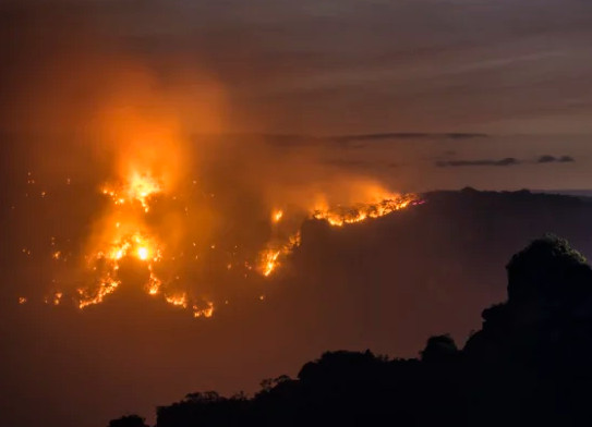
Extensive fires currently burning in the Blue Mountains
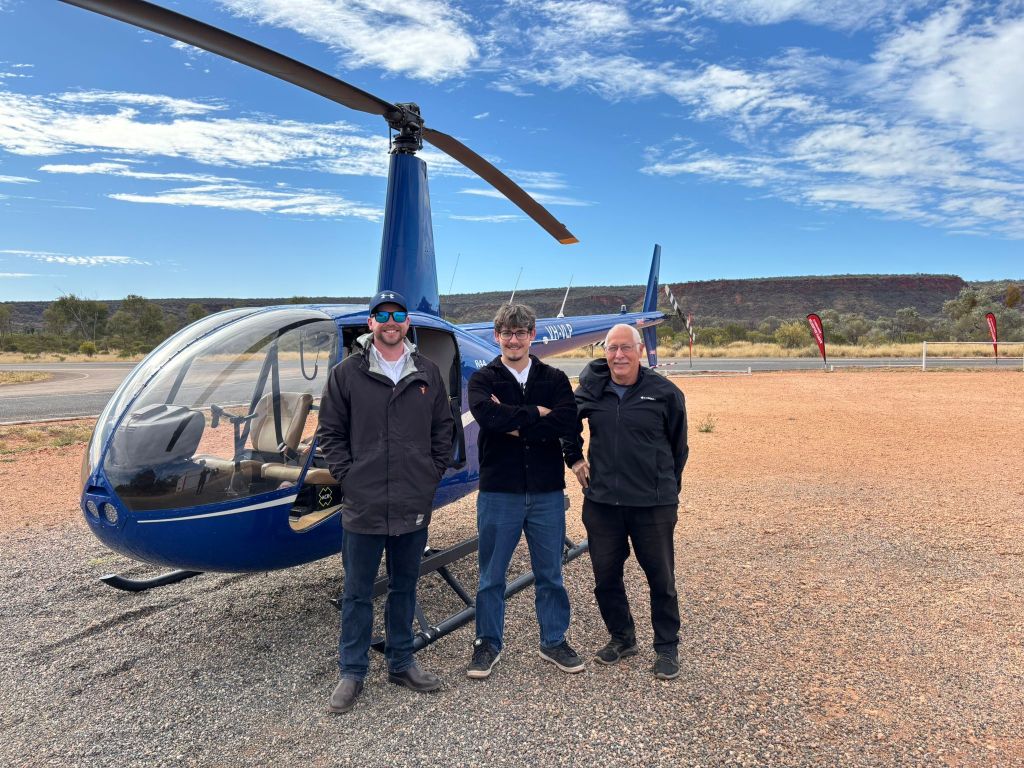
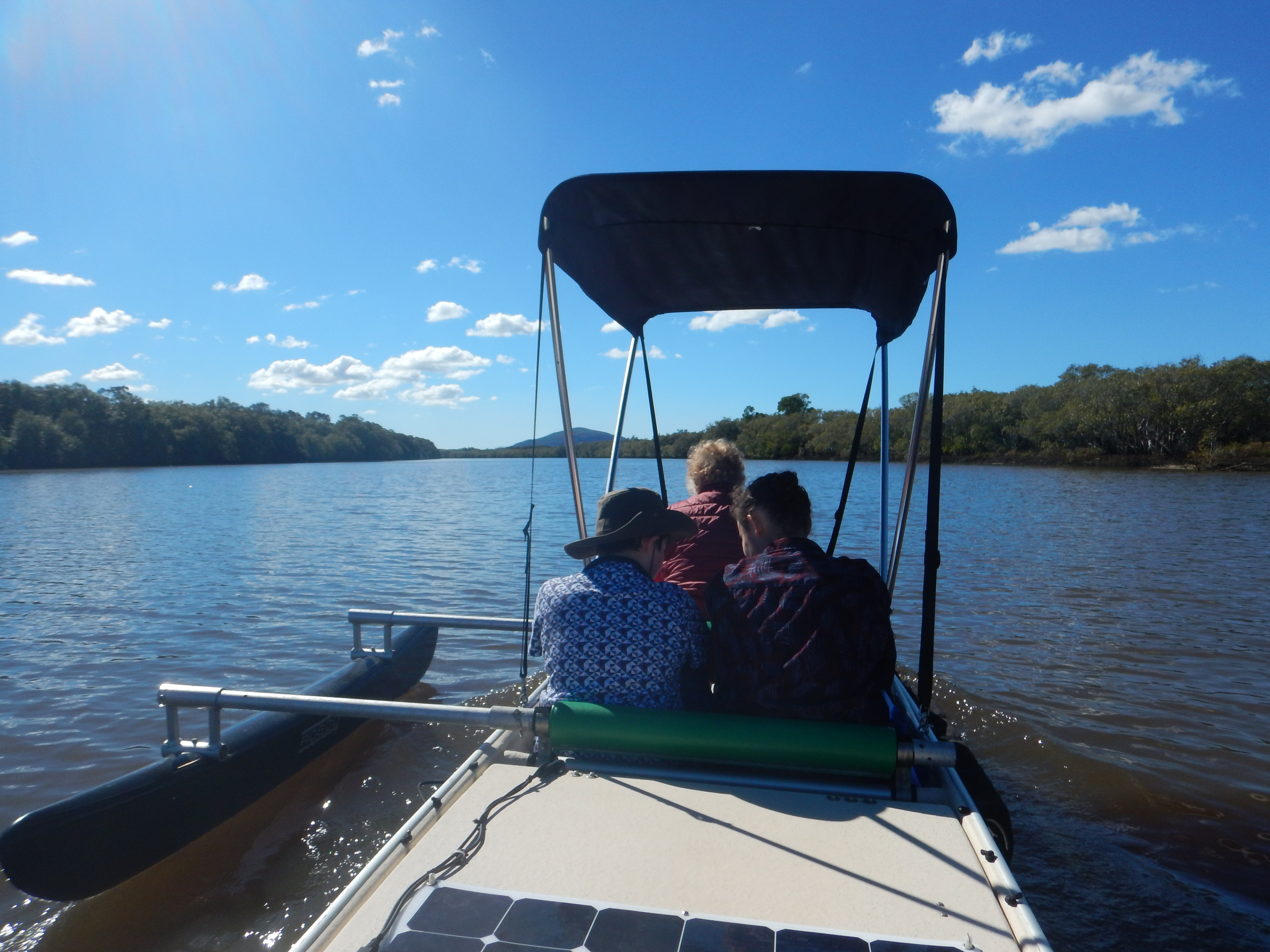
I was in Australia in November to visit family at Noosa. A couple of days before my trip, I was stunned to read on the web that Tewantin, the suburb next to Noosaville where I was headed, was being evacuated because of the threatening bushfire.
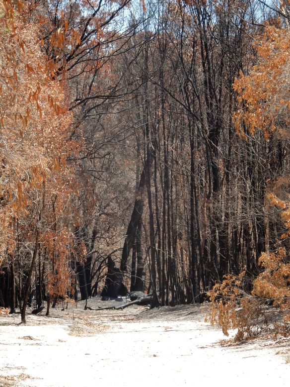
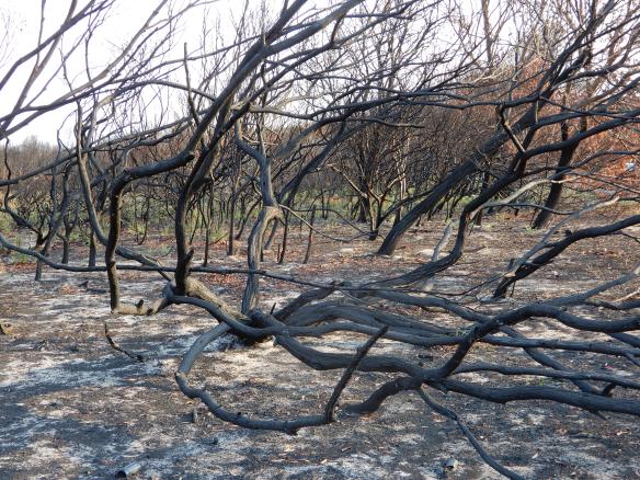
While I was in Noosa, the residents of Noosa North Shore were evacuated because of another fire, as were the people who lived around Lake Cooroibah, about 10 km upstream on the Noosa River. Some days later, I drove up to Cooroibah where I saw extensive burnt areas of bush. The photos below show the fire damage. Most of the trees are evergreen eucalypts (gum trees) and the dead leaves from the heat are orange or brown. Though it may look like autumn colours to those from the Northern Hemisphere, it is actually dead leaves. Most of the larger trees will regenerate, as the ecucalypt forests of Australia have evolved to adapt to fire, with thick bark, an ability to resprout along their entire trunks, and in some cases depend on fire to open their seed pods. Animals such as the koala bear and other threatened species do not do so well, particularly when the fires are widespread and have significant impact on populations.
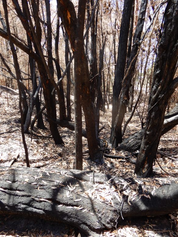
Bushland near Lake Cooroiba
Around 2,500 people were evacuated from about 440 homes in this area, but only one house and some sheds were destroyed. A teenage boy on his own in the house that was destroyed managed to make it into the nearby lake as the fire came over.
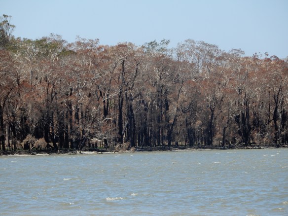
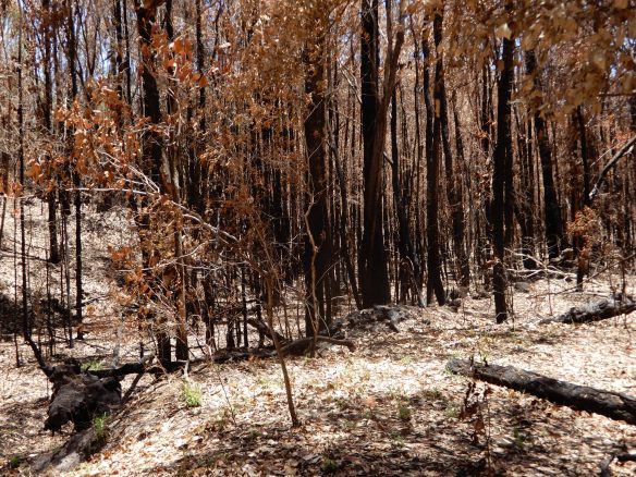
Burnt forest on the shore of Lake Cooroiba
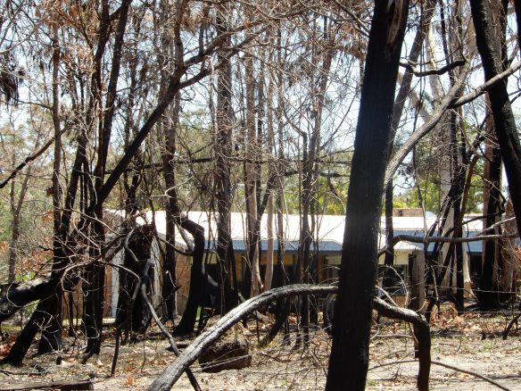
The fire came quite close to this house.
There is a small housing development here, and the fire came within 50 metres of the houses. I spoke to one resident who told me he and his dog stayed, and hid when the police came to evacuate everyone.
Years ago when I lived in Sydney, there were regularly bushfires in the nearby Blue Mountains where increasing numbers of people were living. Those who stayed with their homes were able to put out spot fires, fill gutters with water, and deal with floating embers. Those who left their houses often returned to find the houses burnt down. Of course, those who underestimated the intensity of the fire and stayed sometimes paid with their lives.
So it’s a difficult call whether to stay or leave. One time in the 1980s, I went up to the Blue Mountains to help some friends during a bushfire. We stayed with the house and fought the spot fires successfully. The house was on a ridge and the wind drove the fire up the side of the ridge and over the house. As the fire approached, the heat increased and it became very difficult to breathe due to smoke. We all wrapped ourselves in wet towels and lay flat in the gutter of the road where the air was clearer. The fire passed over us and we were OK, though somewhat terrified. Australian eucalypts have a lot of eucalyptus oil in the leaves, and the heat vaporises this into the air, so that fires will spread at tree height, and in the most intense fires will leap across the tops of the trees as the eucalyptus oil above the trees ignites.
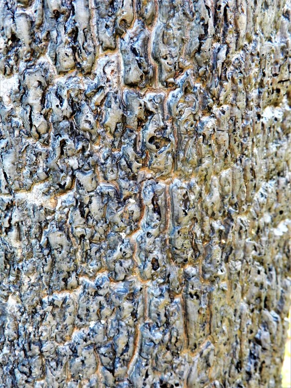
Fire damaged bark on a tree trunk
Returning to 2019, although Australia has always had devastating bushfires in some years, scientists and fire service chiefs have stated that the fire risk this year is the highest ever. Back in August, the The Bushfire and Natural Hazard Cooperative Research Centre (BNHCR) warned that New South Wales and Queensland and some other parts of Australia faced higher than normal fire potential. The Australian Bureau of Meteorology publishes a Forest Fire Danger Index (FFDI) which combines measurement of temperature, humidity, rainfall, evaporation and wind speel. Their cumulative winter index for 2019 (BOM), published in September, shows the overwhelming majority of the country, with a few exceptions in Victoria, central Queensland and western Tasmania, is experiencing between “above average” and “highest on record” fire conditions when compared with the average since 1950 (see map below). The measured FFDI values were in the extreme category (over 75) across large areas, reaching the catastrophic category (FFDI values of 100 or above) at some locations in New South Wales.
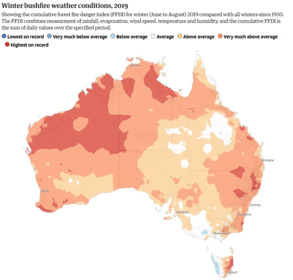
In line with the measured rise in average annual surface temperature over recent decades, the FFDI has been increasing across most of eastern Australia. Projections by Bureau of Meteorology Scientists recently published in Nature (ref), continue to show an increase in FFDI values due to increasing greenhouse gas emissions over the course of the century. This result is robust across a range of climate projection models, methods and metrics. This means that the number of days in the year where the FFDI value represents “Very High” fire danger will increase substantially over the next 50 years.
What is the political response to all this? The Australian Prime Minister Scott Morrison is a climate denialist and stated that there was no evidence to link the increased bushfire risk to climate change. He went further and stole a line from US poliiticians, telling the nation “Now is not the time to discuss possible causes of the fires, instead we must pray for the victims.”
Extinction Rebellion and other forms of climate protest have become more vocal recently, and Morrison recently announced hi intention to outlaw and criminalize protest by climate activists. The Queensland government is also fast-tracking laws to crack down on climate protesters.
The Australian government is also discussing how to outlaw consumer boycotts of businesses such as coal miners. They have a bit of a problem figuring out how to do that as some of the major banks and investment companies are also avoiding investment in fossil fuels.
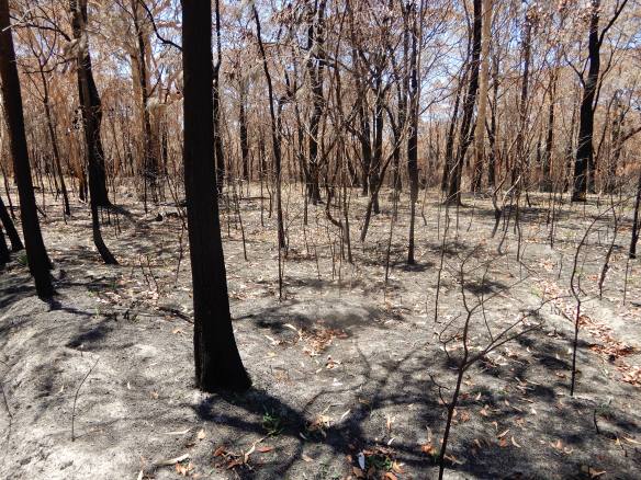
Bushland burnt in September near Peregian Beach