A visit to Uluru and Kata Tjuṯa (the Olgas)

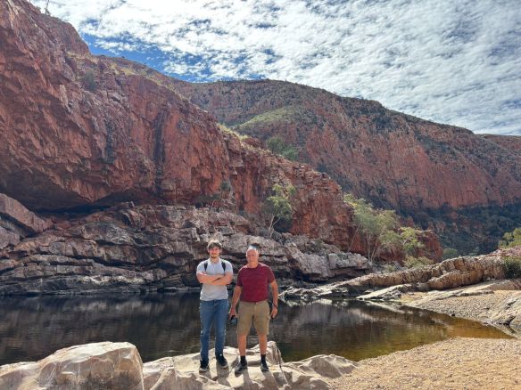
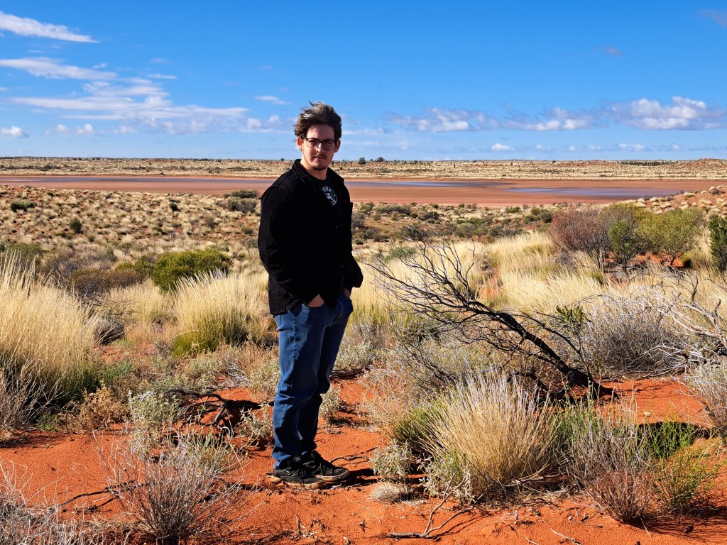
In the last two weeks of July 2025, I took my younger son to central Australia to visit for his first the iconic desert landscape and to explore some of the spectacular desert and mountain scenery. I have visited central Australia a number of times when I was younger, with trips to Alice Springs and Uluru (Ayers Rock), Katherine Gorge and the Arnhem Land Escarpment.

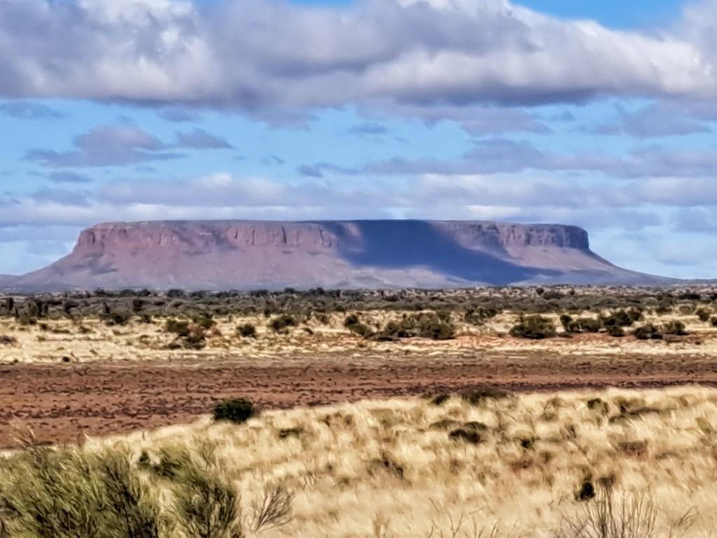
I have included links to previous posts about this trip and the end of this article. From Kings Canyon, we drove 330 km southwest to Uluru, formerly known as Ayers Rock, and perhaps the most famous landmark in Australia. As we headed towards Uluru, the land became extremely flat. The recent rain from the storm during the last night we were in Kings Canyon was widespread and had filled some of the shallow lakes that usually form only in the wet season.

One of the shallow lakes we saw on the way to Uluru, an unusual sight in the dry season.
Mount Conner about 90 km before Uluru — aka Mount Fuluru because many people mistake it for Uluru.

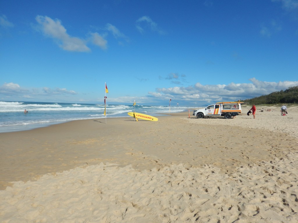
We stayed at a tourist hotel in Yulara, a new settlement about 20 km from Uluru, built specifically to provide tourist accommodation and services, including an airport.

Approaching Uluru from Yulara.

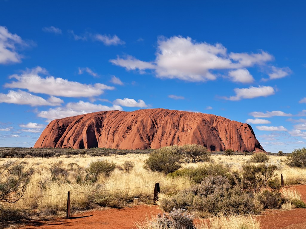
This was my second visit to Uluru. The first was 45 years ago, one week before the dingo took Azaria in August 1980. That was also a memorable trip. One of my friends had found a pilot seeking to increase his flying hours, who was willing to fly the four of us from Sydney to Uluru in a light plane, all for the cost of the fuel. I think we paid a couple of hundred dollars each.

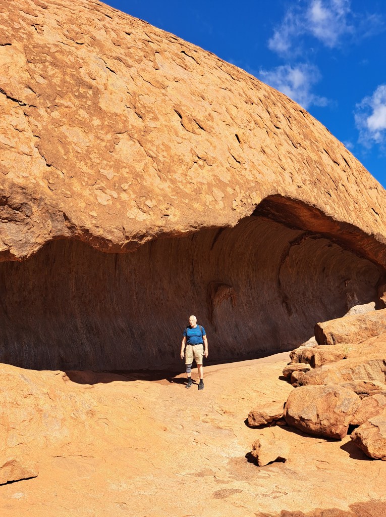
On that first trip, we slept in a cave at the base of Uluru, and the pilot slept under the wing of the aircraft. In those days, it was still possible to climb Uluru, and I climbed it before dawn the next day, to arrive at the summit just before sunrise and to see the shadow of Uluru stretching all the way to the horizon when the sun rose. My three friends were all rock climbers and had decided to do a free solo of Uluru on its other side. I waited on top till they arrived quite some time later, and they looked quite traumatized. It seems the gully they had chosen to climb ended on a steep face which was extremely exposed and pushed my friends well out of their comfort zone.

A brief anecdote. When first writing some notes about my first trip to Ayers Rock, I could not remember exactly which year the trip was, but I knew we were there the weekend before the dingo took the baby Azaria Chamberlain. The baby’s mother Lindy Chamberlain was convicted of murdering the baby, and spent three years in prison before the baby’s clothing was found in a dingo den, and she was exonerated. So I looked up this event on Wikipedia to check the date it occurred, and read the article. In the last paragraph it reported that Lindy and Michael Chamberlain had divorced after these event, Lindy remarried an American who lived in Australia, and the dingo changed its name to Sally and was adopted by a family in Florida. I went back to the article a few days later to get a screenshot for posterity, but unfortunately and eagle-eyed editor had removed the information on the dingo.

I am fairly sure that this cave at the base of Uluru is the one we slept in on my first trip to Uluru.
Aboriginal art on the wall of the cave.
My son and I did a complete circuit around the base of Uluru, an 11 km walk.

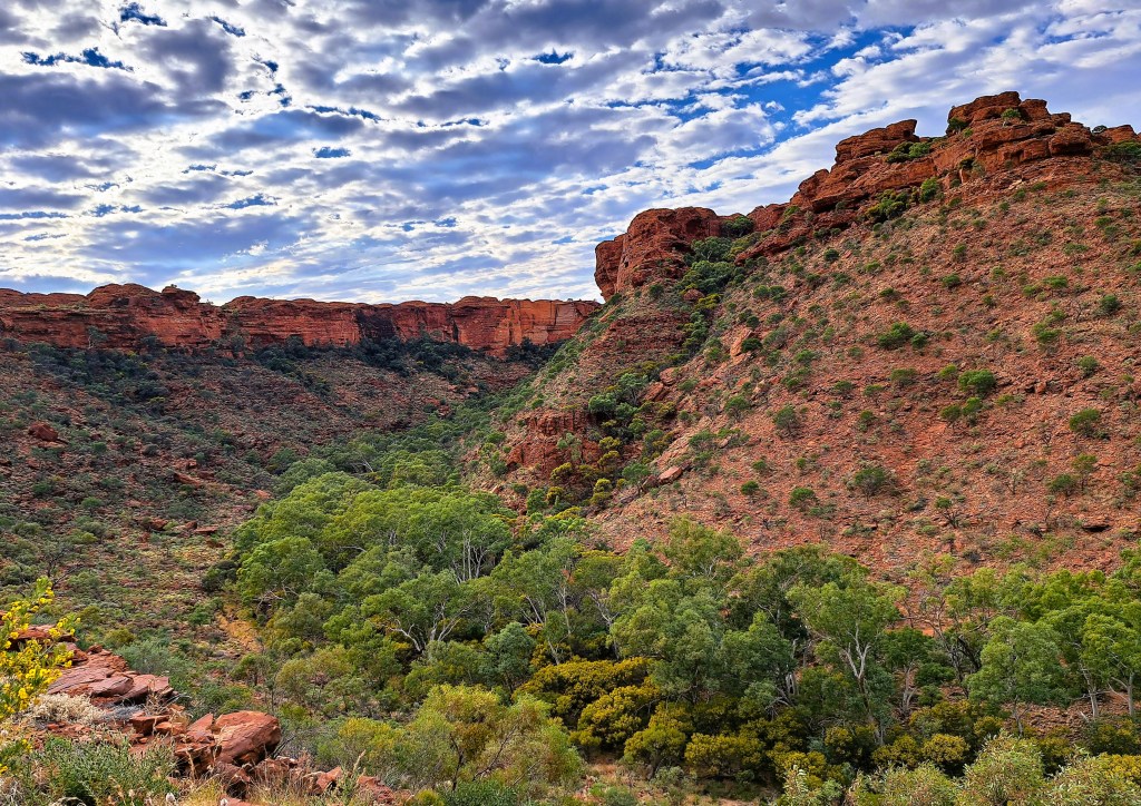
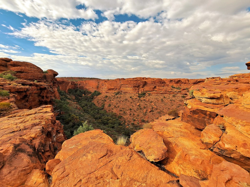
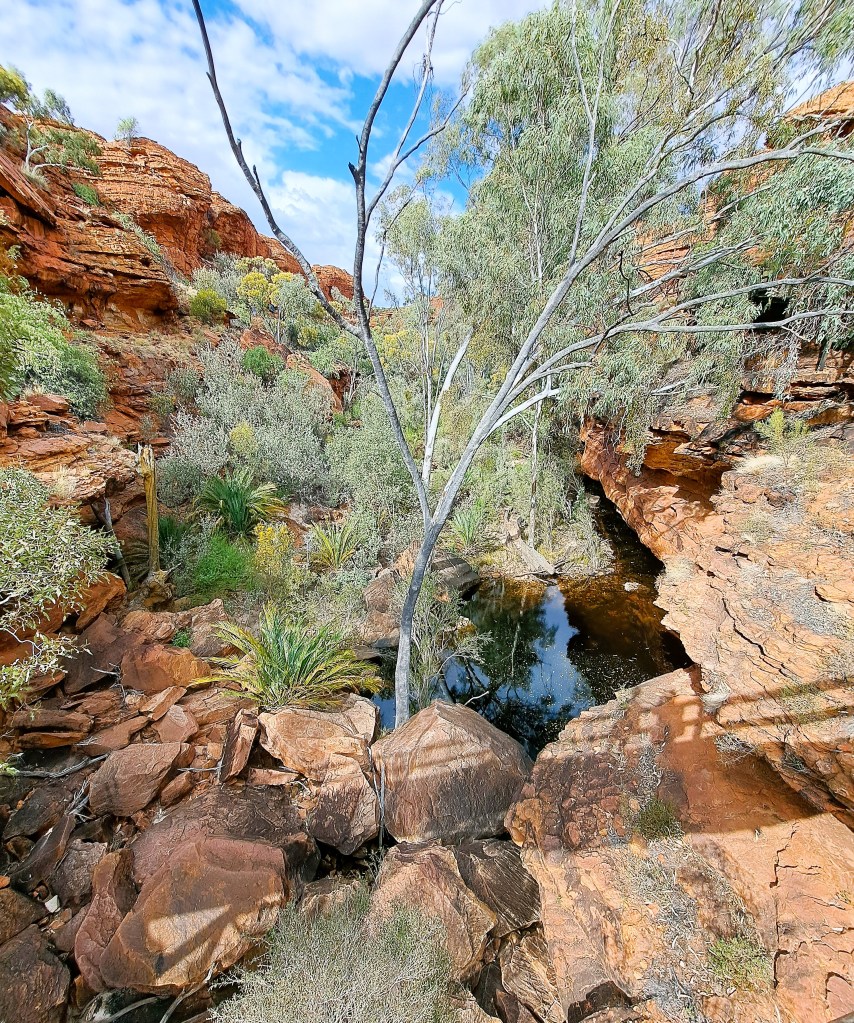
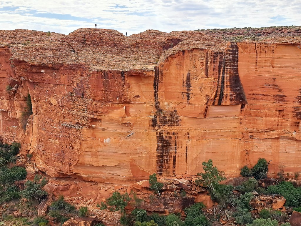
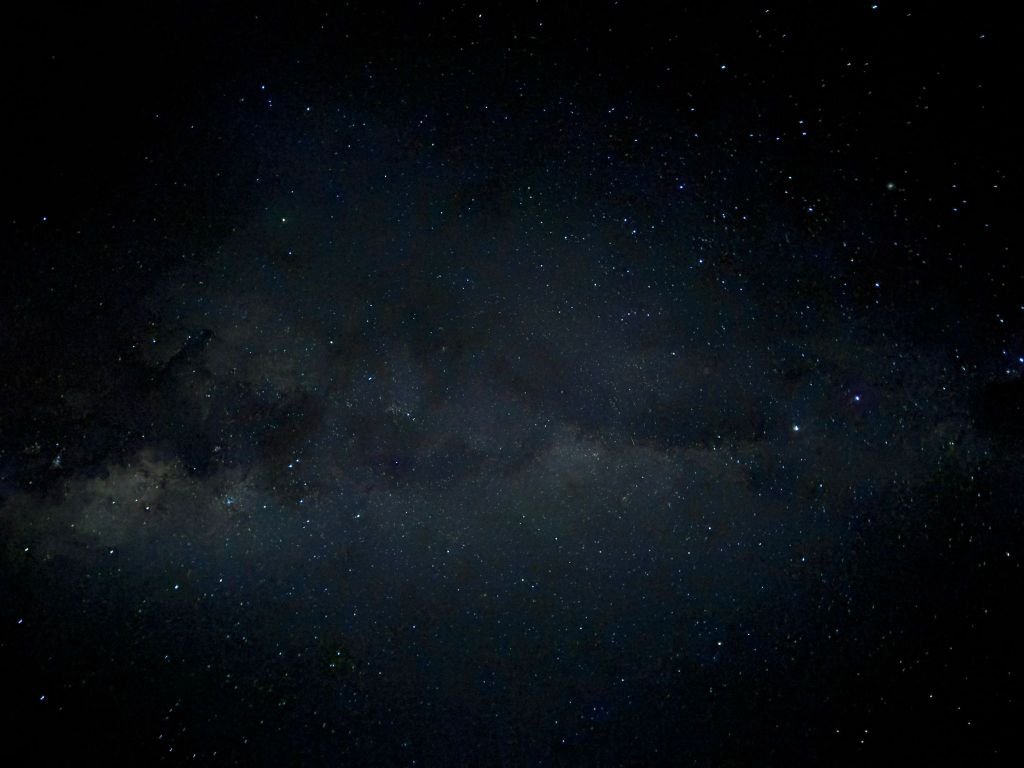
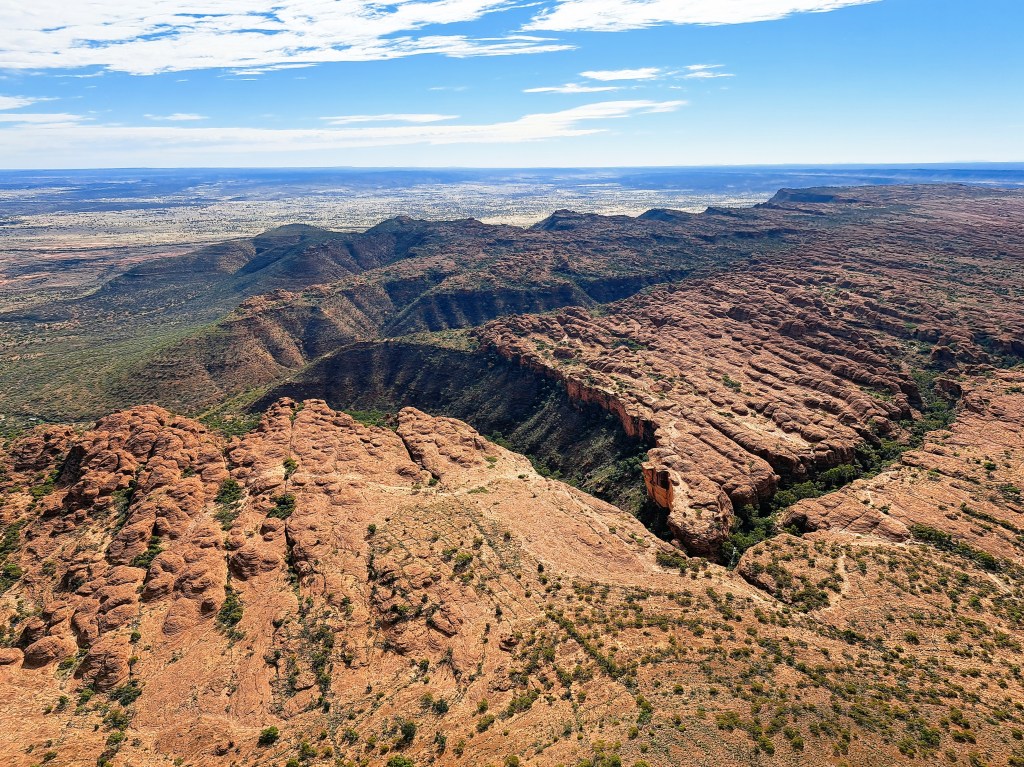
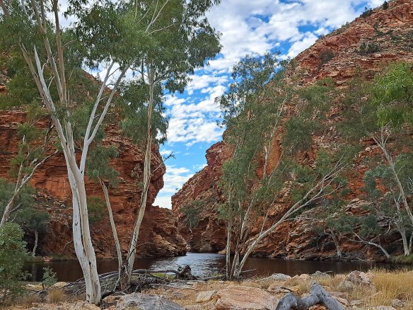
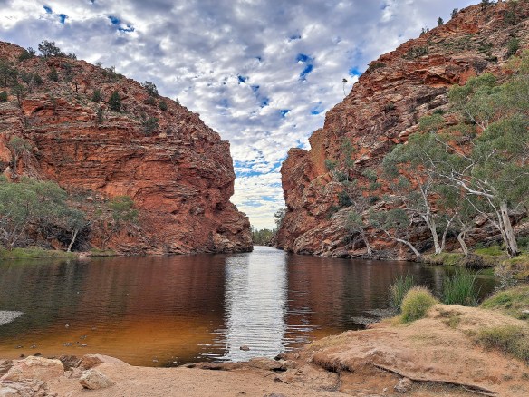
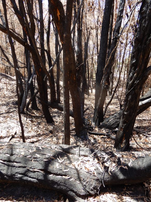
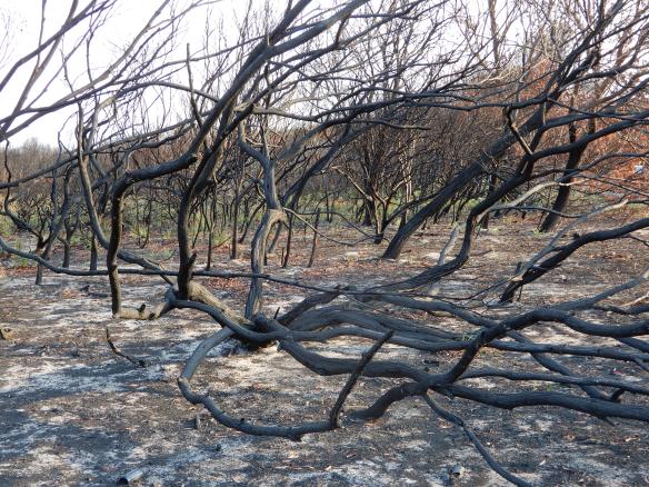
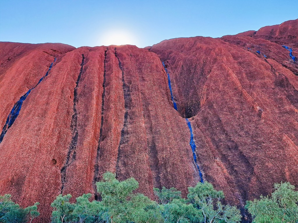
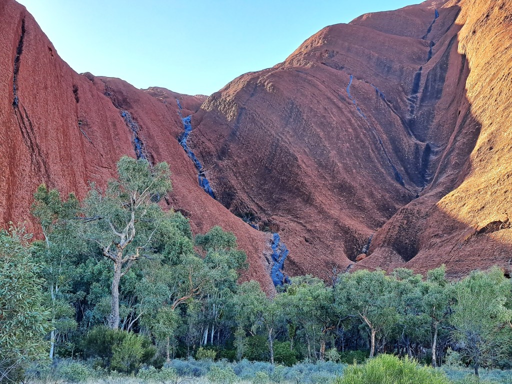
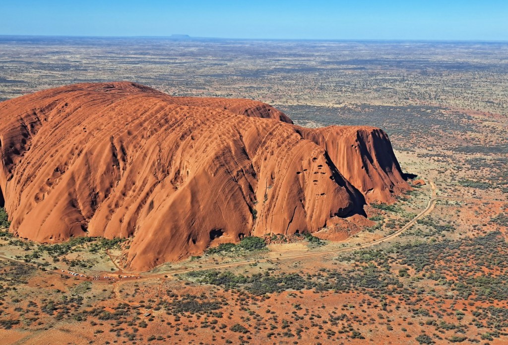
Our last night in Kings Canyon, there was a violent storm with strong wind and heavy rain. As a result there were waterfalls all over the Rock, apparently a rare sight in the dry season.

Waterfalls on the southern flanks of Uluru.

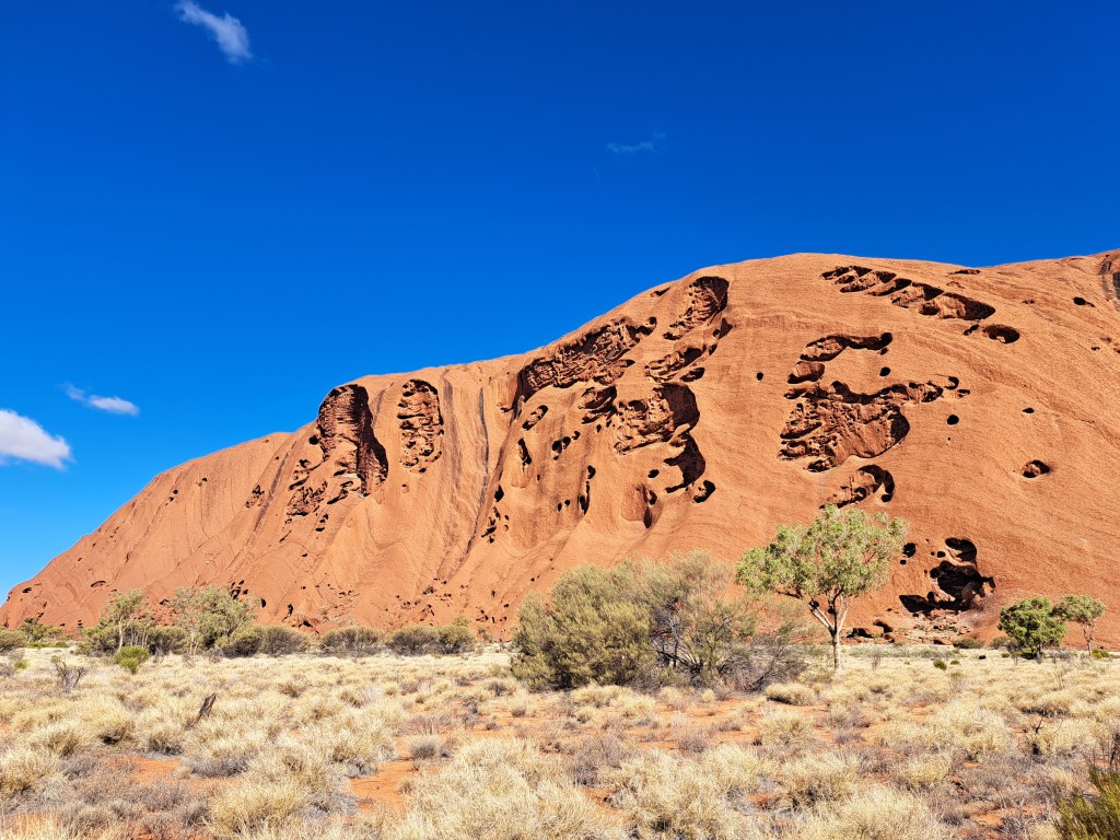
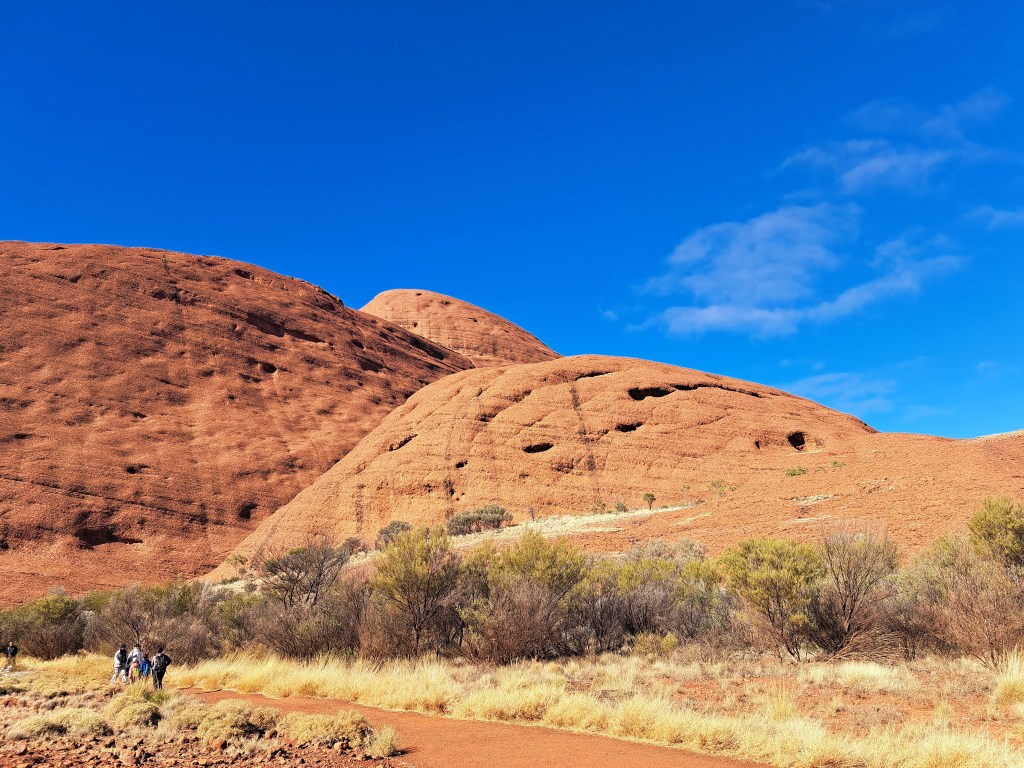
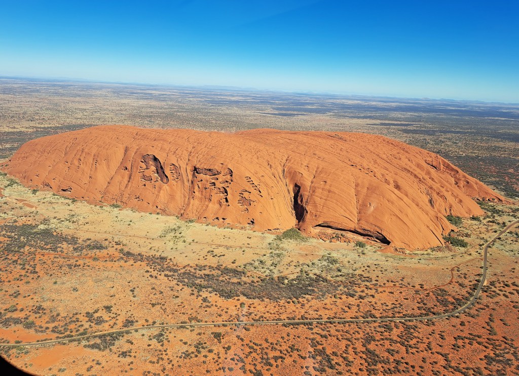
Climbing the Rock was banned in 2019. The track to the summit is still visible as a white line up the ridge that reaches the summit immediately above Felix. Back in 1980, I climbed Uluru via this route.The route was extremely steep towards the top, and there was a chain railing that climbers could use to prevent themselves slipping and falling. At least 37 people died while attempting to climb Uluru (Ayers Rock) since record-keeping began in the 1950s.

Westen end of Uluru, with the former climbing track visible as a white line of the ridge to the left of centre.

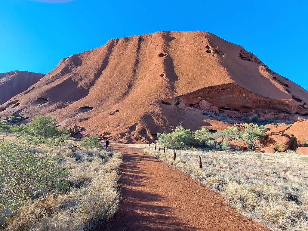
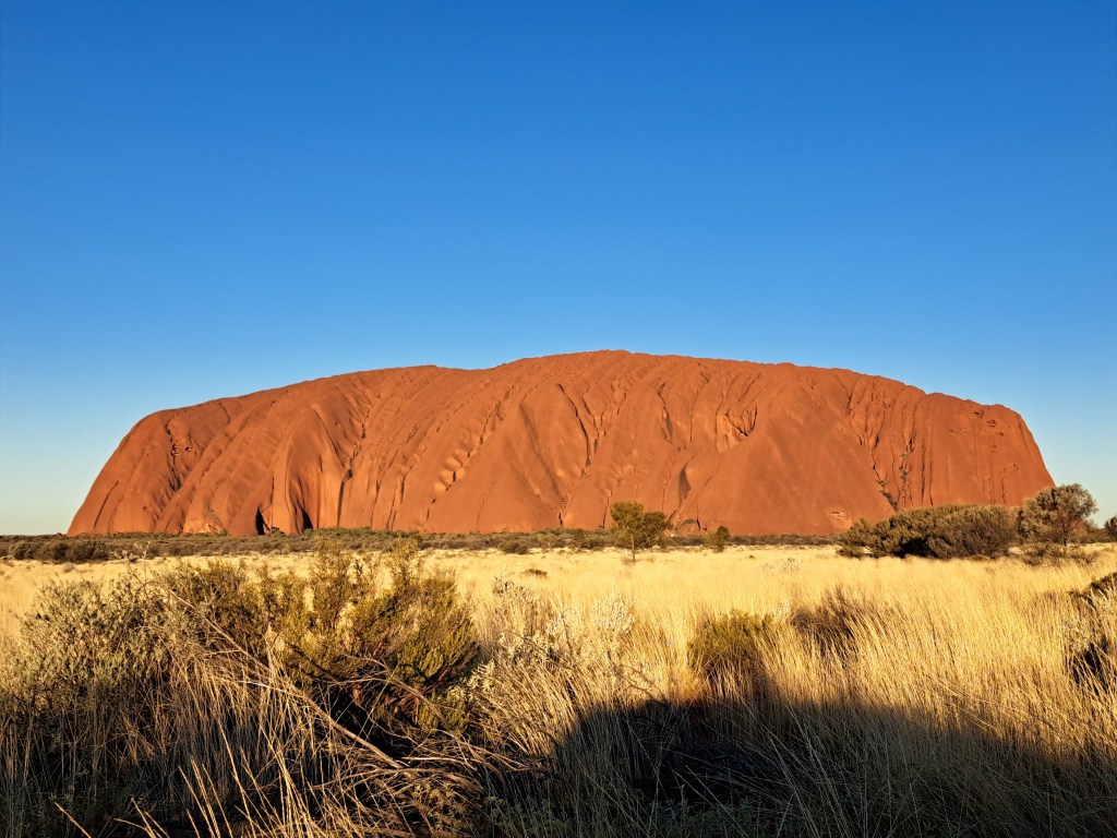
As we headed back to Yulara, the sun was getting low in the sky and turning the Rock red.

Late afternoon sun on Uluru.

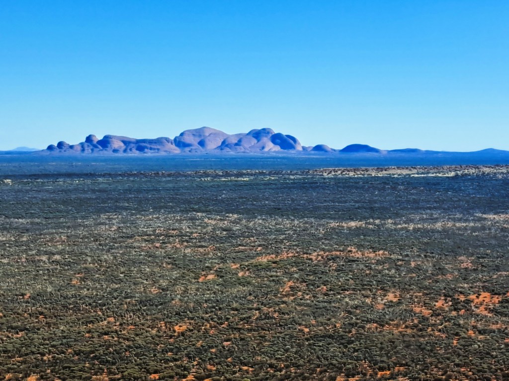
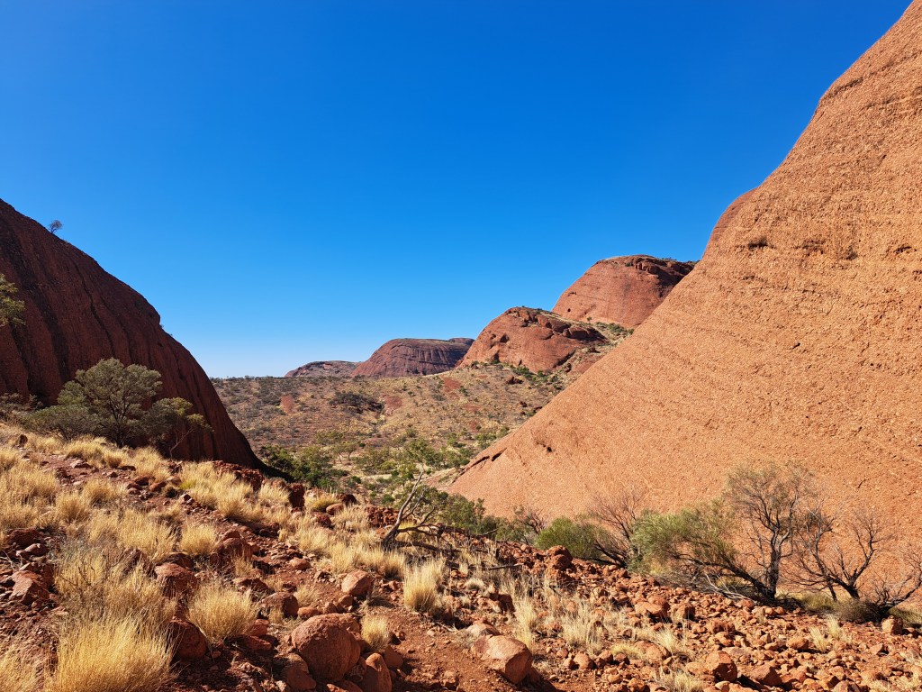
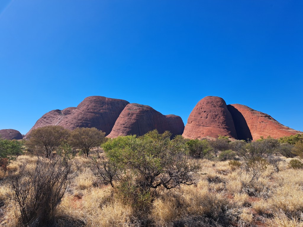
The next day we went out to Kata Tjuṯa (the Olgas), 56 km west of Uluru. This was my first land visit to them. On my first trip in 1980, the pilot had flown us out to the Olgas and we flew low over them getting superb views. I’m quite comfortable with the Aboriginal name for Ayers Rock, but I must admit I have trouble getting Kata Tjuta into my memory banks, and still think of these iconic rocks as the Olgas.

Kata Tjuṯa (the Olgas)/
Looking back to Uluru from the Olgas.
Flowing water in Walpa Gorge, with Mount Olga on the right.
Walking towards the Valley of the Winds
View towards the Valley of the Winds
Looking back as we leave the Olgas to head back to Yulara

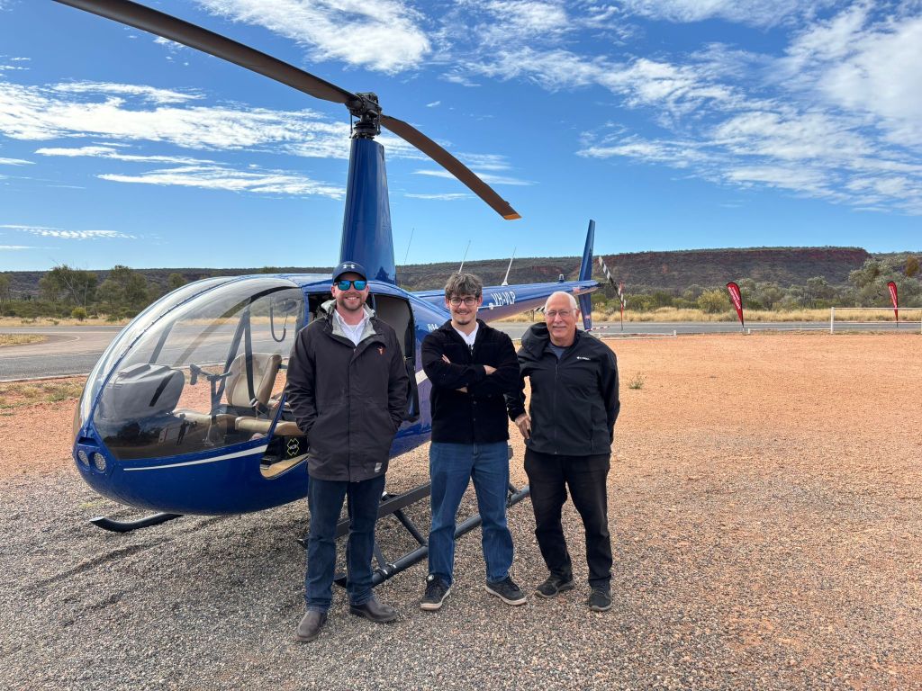
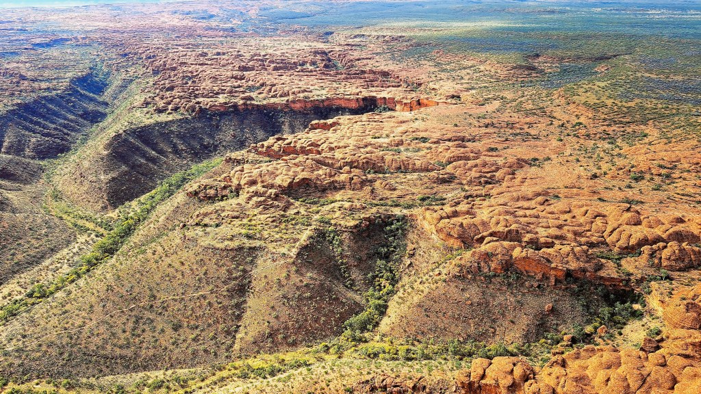
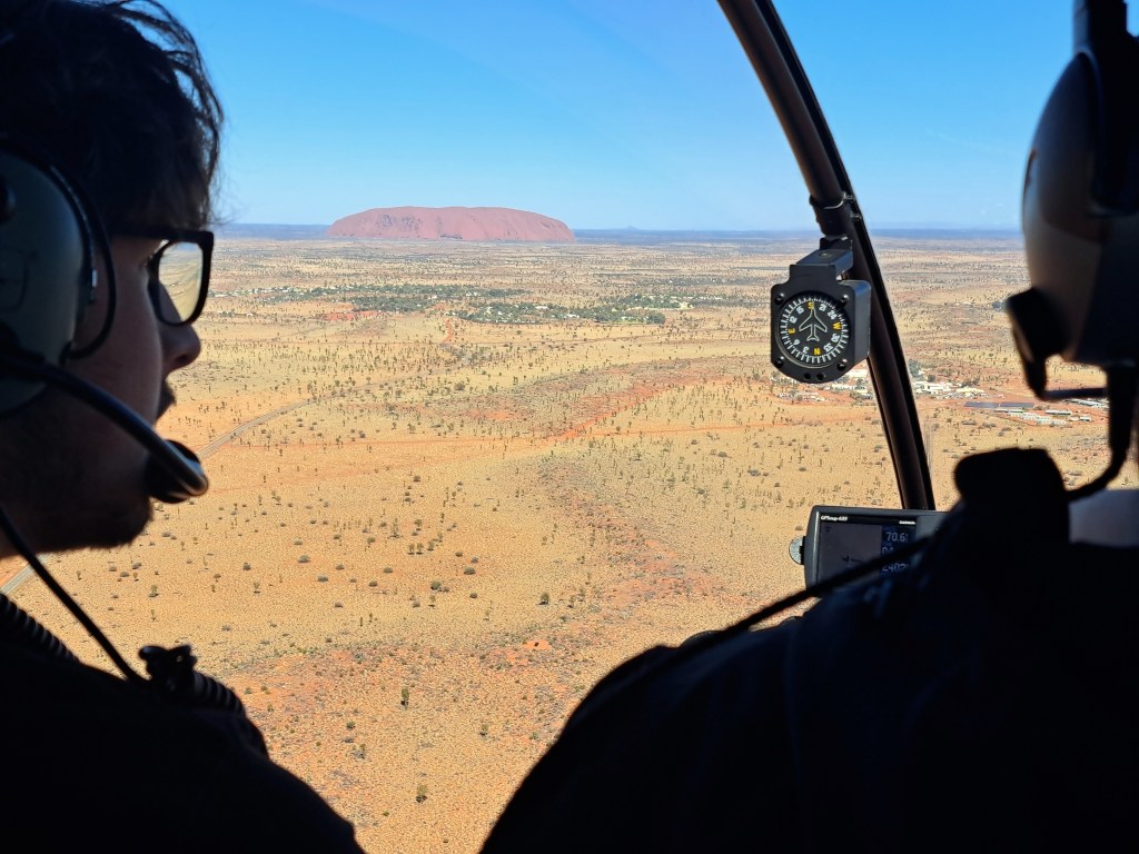
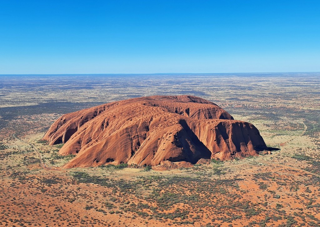
Seeing as we could not climb Uluru, we decided to do another short helicopter flight over it.

Heading towards Uluru in a small helicopter

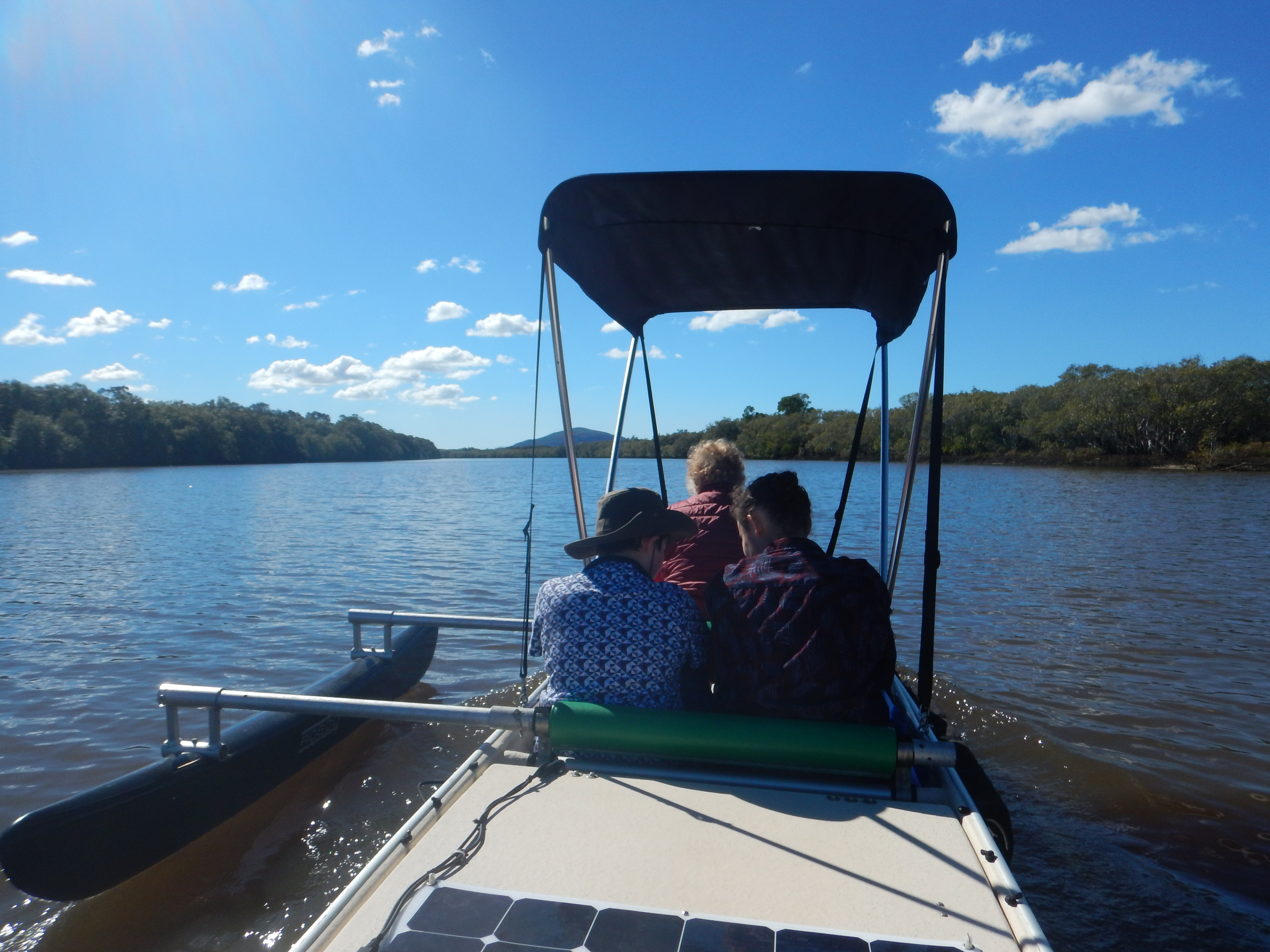
The next day we drove from Uluru to Darwin, a 500 km trip. And spent two days in Darwin, a fascinating city well worth visiting. In the 1990s, I had been collaborating with the Northern Territory Health Department on a joint project and visited Darwin a number of times, so already was quite familiar with it. However, these two days we were able to delve into the history of Darwin, and particularly its experience of being attacked by the Japanese during World War II.  Perhaps I will do another post on that sometime.

Here are links to earlier posts on our explorations of central Australia in 2025.

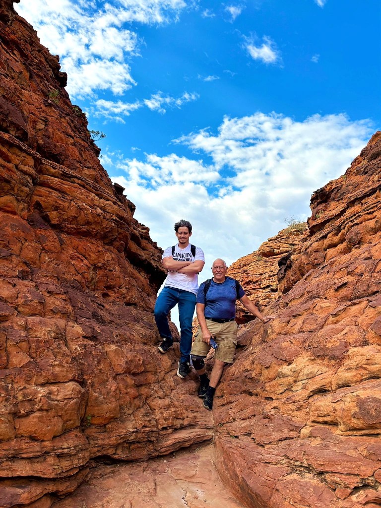
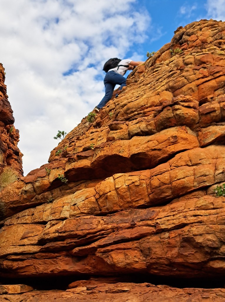
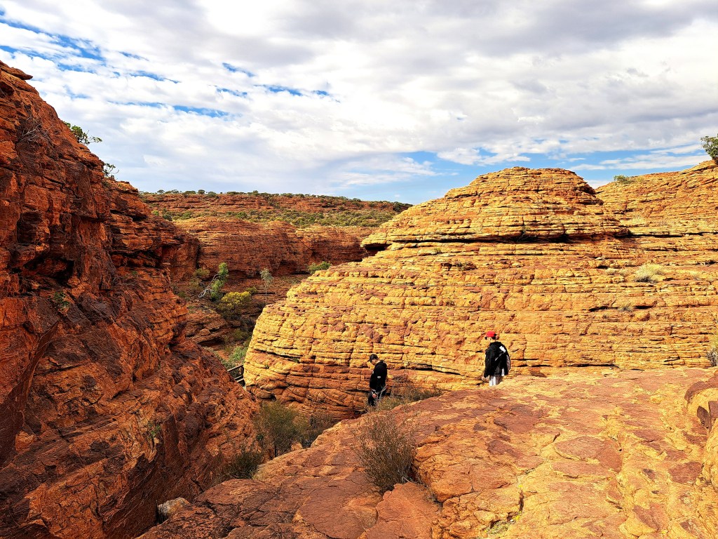
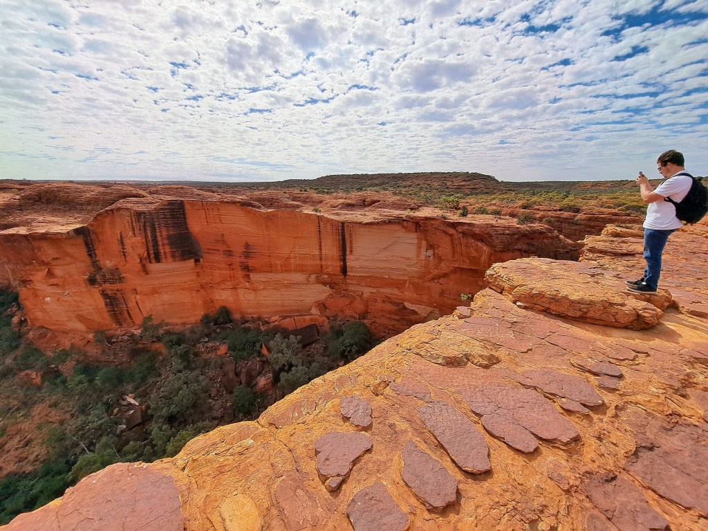
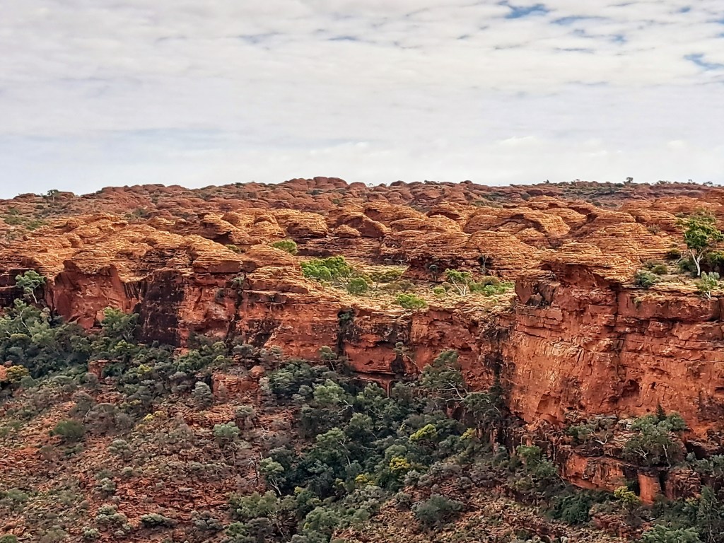
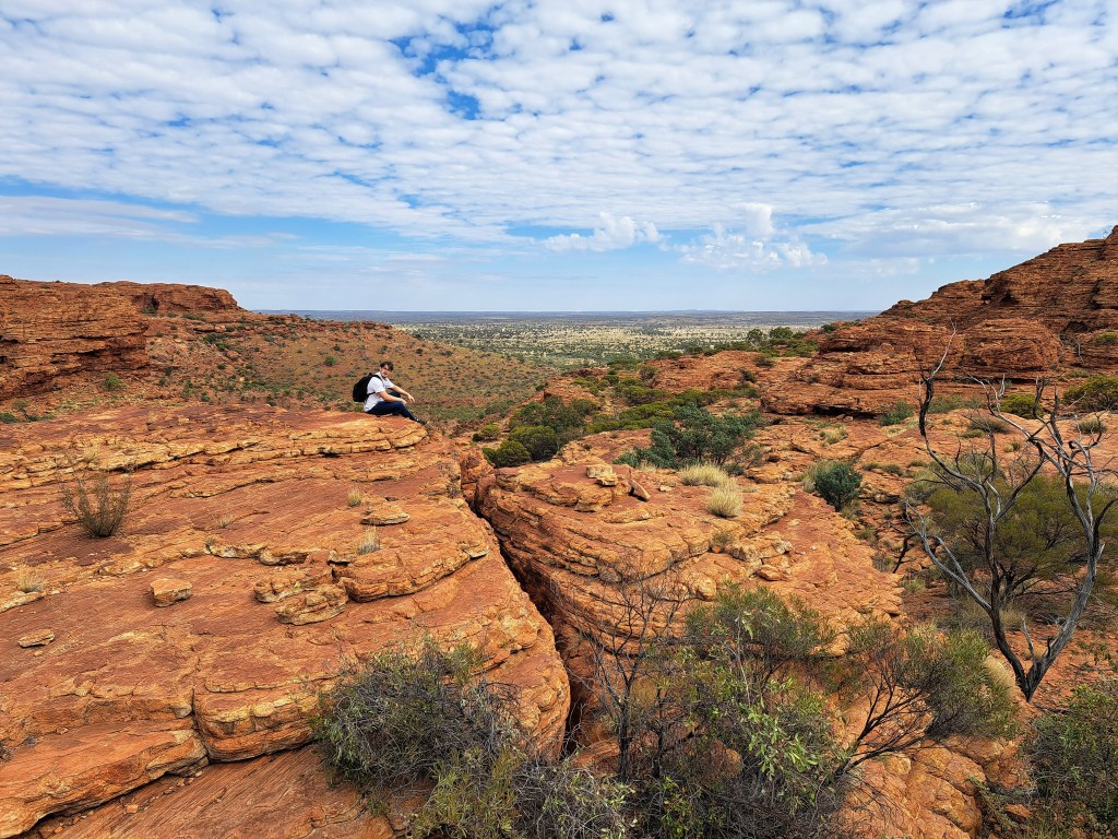
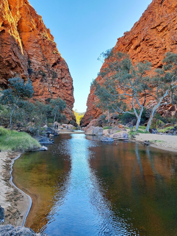
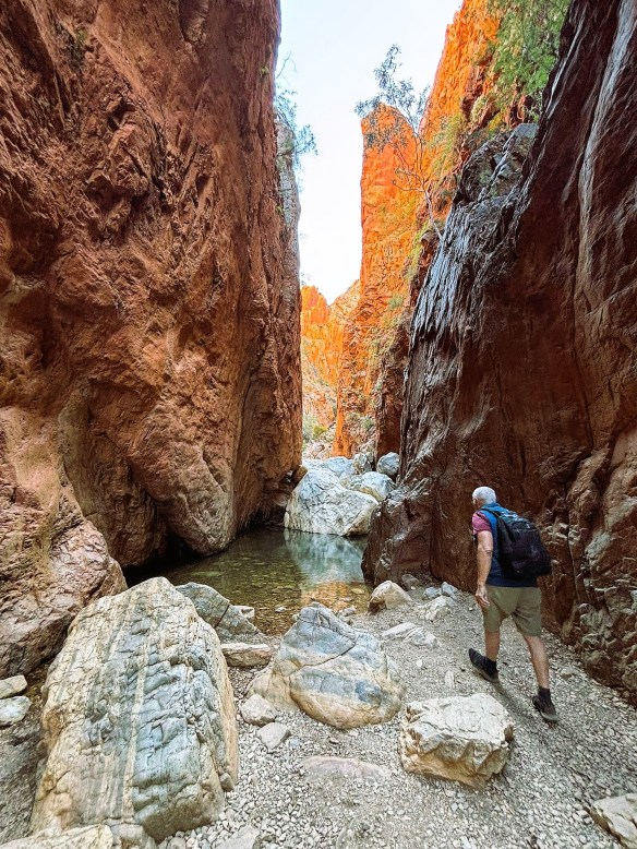
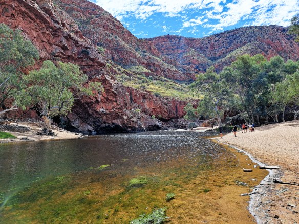
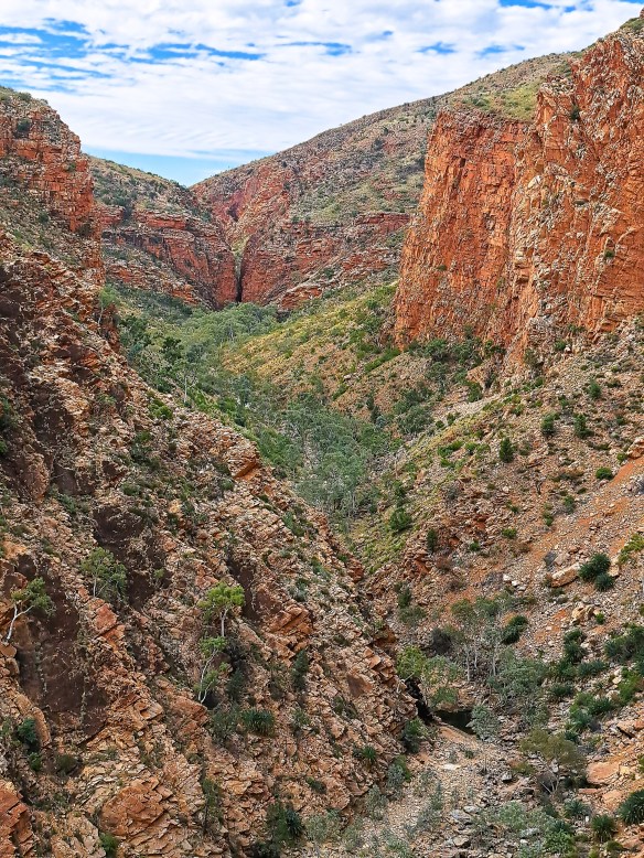
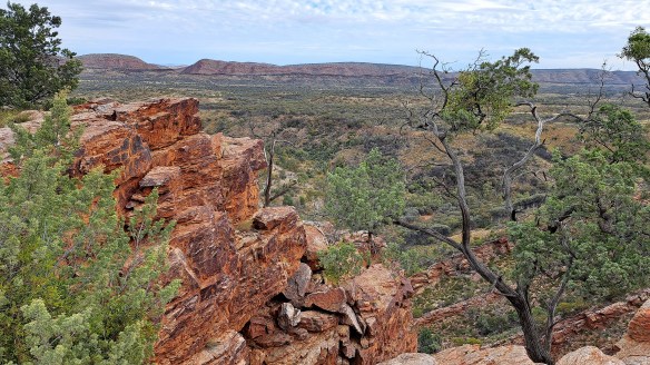
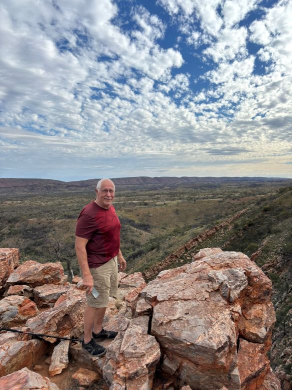
A visit to Kings Canyon in central Australia Part 2

A visit to Kings Canyon in central Australia Part 1

A visit to the West MacDonnell Ranges of central Australia

A visit to Kings Canyon in Central Australia – Part 2

Kings Canyon is located about halfway between Alice Springs and Uluru, by road its about 470 km from Alice. The canyon has been cut 100 m deep into the layered sandstone and shale over a period of 400 million years, creating one the most spectacular landscapes in central Australia. We climbed 500 steps to the western canyon rim, then walked through the dome-like sandstone formations of the “Lost City”, crossing over to the other side of the canyon at a waterhole known as the Garden of Eden, before returning along the eastern rim of the canyon and back down to the bottom of the gorge.

Looking towards Kings Canyon
Nearing the northern rim of the Canyon
Felix and Colin
In the Lost City
These ripples in the sandstone were formed in the shallow
waters of a long extinct sea 400 million years ago.
Felix in the Lost City
Starting the descent into the canyon to the “Garden of Eden”
Garden of Eden
Stairs ascend to the southern rim of the canyon from the Garden of Eden
On the southern rim
Looking across the canyon to the Lost City
The start of the descent back to Kings Creek

We descended to the Kings Creek level and drove back to Kings Creek Station for the night, before heading towards Uluru (Ayers Rock) the next day.

Emus near Kings Creek Station
There were also several camels grazing near the station
There was no light pollution in the desert at night and the stars were spectacular. Felix took this photo of the Milky Way with his iphone, handheld with a 10 second exposure.

When we returned to Switzerland, I told Felix we needed to watch The Adventures of Priscilla Queen of the Desert, a great 1994 Australian movie in which two drag queens and a transgender woman travel through outback Australia and visit some of the places we had just seen. So we both watched it and realized that the climactic scene where drag queens Tick, Felicia, and Bernadette climb to the a cliff and gaze across the landscape was filmed at Kings Canyon and we recognized the path they climbed to the top of Kings Canyon. We even walked through the narrow chasm in the photo below from the movie. Its now known as “Priscilla’s Crack.”

The drag queens in Priscilla’s Crack 31 years ago. The lead character in red is played by Hugo Weaving, who went on the play Elrond in The Lord of the Rings movies.

In the penultimate scene of the film, the trio stand triumphant on top of Kings Canyon’s south wall; they’ve survived not only the hike, but the existential threat of bringing Sydney’s drag culture to the outback. The grandeur of the 400-million-year-old landscape in the sweeping panorama only magnifies the accomplishment. “It never ends, does it? All that space,” Terence Stamp’s character, Bernadette, remarks.

A visit to Kings Canyon in Central Australia – Part 1

After visiting the West McDonnell Ranges (see previous post), we headed for Kings Canyon, which I had not visited before. Kings Canyon is located about halfway between Alice Springs and Uluru, by road its about 470 km from Alice. The canyon has been cut 100 m deep into the layered sandstone and shale over a period of 400 million years, creating one the most spectacular landscapes in central Australia.

We had booked a tent for two nights at Kings Creek Station, about 36 km before Kings Canyon. When we got there, we discovered that they had a small helicopter, and arranged to take a flight over Kings Canyon. This was Felix’s first time in a helicopter, and it was the smallest I had ever been in. The pilot took the doors off it so we could have unobstructed views.

Below is a short video and a few photos from the air. The views were spectacular. It was extremely windy in the open helicopter as we were flying at 180 km/hr and there were strong cross-winds. It was quite exhilarating to be flying with the wind buffeting us and essentially just a framework of metal around us open to the sky around us and the ground below.

Kings Canyon

A visit to the West McDonnell Ranges of Central Australia

My younger son Felix and I visited relatives in Australia in July last year. In the last week of our trip, I took Felix to the “red centre” of Australia to explore some of the spectacular desert and mountain scenery. I have visited central Australia a number of times when I was younger, with trips to Alice Springs and Uluru (Ayers Rock), Katherine Gorge and the Arnhem Land Escarpment. Felix is an Australian by descent, but had never visited the centre before.

We flew from Brisbane to Alice Springs to spend ten days in the Northern Territory. We hired a four-wheel drive car for a week, and spent our first day exploring Alice Springs. We then spent a day in the West MacDonnell Ranges, driving 140 km west of Alice Springs and visiting some of the many spectacular gaps and gorges as well as areas of Aboriginal significance.

Simpson’s Gap, 24km from Alice Springs. The rock walls are home to the rare and endangered Black-footed Rock Wallaby. Felix managed to spot one when he was scrambling around.
Standley Chasn is a 25 minute walk along a natural creek bed from the road head, through acaciasm cycads and ghost gums, until the dramatic 80m sheer rockfaces of the Chasm are reached.
MacDonnell Ranges in the distance
The Dryland Feather-Head (Ptilotus xerophilus) was only recognized as a separate species restricted to central and western Australian in 2019, distinct from a similar eastern Australian species.
Although they rise only 400-500 metres from the surrounding mulga scrub, the highest peak in the McDonnells, Mount Giles) is Australia’s 3rd highest mountain above sea level, at 1,389m.
The Ochre Pits is an Aboriginal sacred site. The rock walls are covered with layers of red, yellow and white ochre.It provides material traditionally uised for ceremonies and trading.
Ormiston Gorge is 136 km from Alice Springs and contains a quite large semi-permanent waterhole. A great place for a swim on a hot day.
Felix and I at Ormiston Gorge

We drove a little further on from Ormiston Gorge to the Finke River crossing, then turned back to head to Alice Springs, stopping on the way at Serpentine Gorge and Ellery Creek Big Hole. I have to say, despite the spectacular beauty of the places we had already visited, I was blown away by Serpentine Gorge. We climbed a steep path to the top of the eastern wall of the gorge, and the views in all directions were stunning. Felix and I saw another rare Black-Footed Wallaby quite close to us on a rock near the rim of the cliff.

Serpentine Gorge
View south from Serpentine Gorge
Me on the rim of the gorge, and the view towards the west.
Ellery Creek Big Hole

To be continued…..as we head south west towards Kings Canyon.

Memories of Angkor Wat – 1995

In March 1995, I spent two weeks in Cambodia and was able to make a visit to Angkor Wat. At that time, the Khmer Rouge were still active. As part of the peace process following the civil war of the 1980s, the UN-sponsored elections in 1993. The Khmer Rouge excluded itself from the peace process and maintained control of areas in northwestern Cambodia, in the provinces of Battambang and Siem Reap (where Angkor Wat was located), and neighbouring Thailand. Its forces numbered around 10,000 fighters and were able to extend Khmer Rouge control to more than half a million Cambodians, four times as many as before the peace accords. During the dry season in late 1994 and early 1995, the Khmer Rouge adopted new tactics, including the murder of civilians, the systematic destruction of civilian homes and rice fields, looting, rape and the kidnapping and murder of Westerners.

Continue reading

Winter surfing on the Sunshine Coast

I returned to Australia with my son in late June this year. Our first trip back since the pandemic started. We stayed with my sister, who lives in Noosa on the Queensland Sunshine Coast. It was winter there, but Queensland winters are mild by European standards. We surfed at Sunshine Beach a number of times and thoroughly enjoyed it. Ocean temperature was on the cool side at 19-20 degrees C, but it was colder out of the water with air temperatures around 15-17 degrees and usually with a sea breeze.

Sunshine Beach life saver on duty

Most days there were a handful of people in the surf. On the day the photo above was taken, there were only two others in the water. The lifeguard was sitting in the truck. He did use his loudhailer twice to chastise my son, who was outside the flags and too far out.

Continue reading

Some mushrooms found in the woods of the Netherlands

I have just returned from a week in the Netherlands. I spent five days at a retreat in the woods of Lage Vuursche, situated south of Amsterdam not too far from Utrecht. Wandering in the woods, I came across some beautiful mushrooms and fungi. I had not brought a camera on this trip, but took these photos using my phone.

Shaggy ink caps (Coprinus comatus)
Continue reading

Australian bushfires and global warming

At the beginning of December, 118 forest fires were burning in NSW, 48 of them out of control. The bushfire season started much earlier this year, with more than 140 fires in northern New South Wales (NSW) and Queensland, which destroyed over 600 homes and killed six people. One of these fires destroyed the Binna Burra resort in the Lamington National Park, as well as surrounding rainforest. This was followed by another outbreak of bushfires in November, with more than 129 bushfires in NSW and Queensland. At least 200 houses were destroyed and four people killed.

By the end of November, around 2 million hectares (5 million acres) of bushland had been burnt, and all this before the start of summer and the traditional bushfire season  According to the Climate Council of Australia, the catastrophic, unprecedented fire conditions currently affecting NSW and Queensland have been aggravated by climate change. Bushfire risk was exacerbated by record breaking drought, very dry fuels and soils, and record breaking heat. Since the mid-1990s, southeast Australia has experienced a 15% decline in late autumn and early winter rainfall and a 25% decline in average rainfall in April and May. Across Australia average temperature has increased leading to more record breaking hot weather. Extreme fire danger days have increased.

Extensive fires currently burning in the Blue Mountains

I was in Australia in November to visit family at Noosa. A couple of days before my trip, I was stunned to read on the web that Tewantin, the suburb next to Noosaville where I was headed, was being evacuated because of the threatening bushfire.

While I was in Noosa, the residents of Noosa North Shore were evacuated because of another fire, as were the people who lived around Lake Cooroibah, about 10 km upstream on the Noosa River. Some days later, I drove up to Cooroibah where I saw extensive burnt areas of bush.  The photos below show the fire damage. Most of the trees are evergreen eucalypts (gum trees) and the dead leaves from the heat are orange or brown. Though it may look like autumn colours to those from the Northern Hemisphere, it is actually dead leaves. Most of the larger trees will regenerate, as the ecucalypt forests of Australia have evolved to adapt to fire, with thick bark, an ability to resprout along their entire trunks, and in some cases depend on fire to open their seed pods.  Animals such as the koala bear and other threatened species do not do so well, particularly when the fires are widespread and have significant impact on populations.

Bushland near Lake Cooroiba

Around 2,500 people were evacuated from about 440 homes in this area, but only one house and some sheds were destroyed. A teenage boy on his own in the house that was destroyed managed to make it into the nearby lake as the fire came over.

Burnt forest on the shore of Lake Cooroiba

The fire came quite close to this house.

There is a small housing development here, and the fire came within 50 metres of the houses. I spoke to one resident who told me he and his dog stayed, and hid when the police came to evacuate everyone.

Years ago when I lived in Sydney, there were regularly bushfires in the nearby Blue Mountains where increasing numbers of people were living. Those who stayed with their homes were able to put out spot fires, fill gutters with water, and deal with floating embers. Those who left their houses often returned to find the houses burnt down. Of course, those who underestimated the intensity of the fire and stayed sometimes paid with their lives.

So it’s a difficult call whether to stay or leave. One time in the 1980s, I went up to the Blue Mountains to help some friends during a bushfire. We stayed with the house and fought the spot fires successfully. The house was on a ridge and the wind drove the fire up the side of the ridge and over the house. As the fire approached, the heat increased and it became very difficult to breathe due to smoke. We all wrapped ourselves in wet towels and lay flat in the gutter of the road where the air was clearer. The fire passed over us and we were OK, though somewhat terrified. Australian eucalypts have a lot of eucalyptus oil in the leaves, and the heat vaporises this into the air, so that fires will spread at tree height, and in the most intense fires will leap across the tops of the trees as the eucalyptus oil above the trees ignites.

Fire damaged bark on a tree trunk

Returning to 2019, although Australia has always had devastating bushfires in some years, scientists and fire service chiefs have stated that the fire risk this year is the highest ever. Back in August, the The Bushfire and Natural Hazard Cooperative Research Centre (BNHCR) warned that New South Wales and Queensland and some other parts of Australia faced higher than normal fire potential. The Australian Bureau of Meteorology publishes a Forest Fire Danger Index (FFDI) which combines measurement of temperature, humidity, rainfall, evaporation and wind speel. Their cumulative winter index for 2019 (BOM), published in September, shows the overwhelming majority of the country, with a few exceptions in Victoria, central Queensland and western Tasmania, is experiencing between “above average” and “highest on record” fire conditions when compared with the average since 1950 (see map below). The measured FFDI values were in the extreme category (over 75) across large areas, reaching the catastrophic category (FFDI values of 100 or above) at some locations in New South Wales.

In line with the measured rise in average annual surface temperature over recent decades, the FFDI has been increasing across most of eastern Australia. Projections by Bureau of Meteorology Scientists recently published in Nature (ref), continue to show an increase in FFDI values due to increasing greenhouse gas emissions over the course of the century. This result is robust across a range of climate projection models, methods and metrics. This means that the number of days in the year where the FFDI value represents “Very High” fire danger will increase substantially over the next 50 years.

What is the political response to all this?  The Australian Prime Minister Scott Morrison is a climate denialist and stated that there was no evidence to link the increased bushfire risk to climate change. He went further and stole a line from US poliiticians, telling the nation “Now is not the time to discuss possible causes of the fires, instead we must pray for the victims.”

Extinction Rebellion and other forms of climate protest have become more vocal recently, and Morrison recently announced hi intention to outlaw and criminalize protest by climate activists. The Queensland government is also fast-tracking laws to crack down on climate protesters.

The Australian government is also discussing how to outlaw consumer boycotts of businesses such as coal miners. They have a bit of a problem figuring out how to do that as some of the major banks and investment companies are also avoiding investment in fossil fuels.

Bushland burnt in September near Peregian Beach

The Maroochy Wetlands

While in Australia recently, I took my boys on a trip up the Maroochy River into the Maroochy wetlands. We had all enjoyed our canoe trip into the Noosa Everglades the previous year (https://mountainsrivers.com/2018/09/06/canoeing-in-the-noosa-everglades/) but this time we had a solar-powered canoe. The solar panel charges a battery that runs an electric outboard motor. It produces a reasonable speed and is very quiet. And we certainly appreciated the ease of gliding upriver without effort.

Continue reading